Phillips Ridge to Golden Hinde plus Mt. Burman, Vancouver Island, B.C.
Subtitle: A Seven-Day Backpack with Five Days of Food
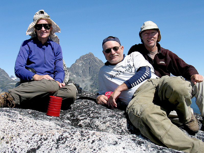
Trip Report: September 2005 by Richard L. Carey
Note: For those of you reading this at the office when you should be working, I'll get to the point and save you a lot of time by revealing that we did not reach the summit of Golden Hinde. We did reach the summit of Mt. Burman however, a fine peak.
Our trip started from Bellingham, Washington where my friend Shelley Rogers and I met up with Terry Flood at his brother Matt's home. Matt was kind enough to put us up for the night and we had a nice dinner at his place near Lake Whatcom. On Wednesday, July 27th we headed for Canada and after a quick border-crossing drove to the Tsawwassen Ferry terminal. We didn't have any Canadian money, but it didn't matter since the attendant was quite happy to charge the $58.00 Canadian to Shelley's Visa card. We were able to use an ATM at the nearby quay market and get some Canadian money while waiting for the next boat.
After driving my truck and Terry's car onto the second deck we enjoyed the two-hour ride on the Queen of Alberni to Nanaimo on Vancouver Island. We quickly got onto the Inland Island Highway, which is like our Interstate except for a few annoying stoplights, and drove the 95 miles up to Campbell River. After gassing up we headed west then south to Buttle Lake. This is a long lake surrounded by high-forested mountains. We pulled into Ralph River Campground and found a spot nestled in the tall trees. There were quite a few people here even midweek. The mosquitoes found us as we spread out our gear and arranged our packs. Thursday we motored the 8.8 miles to the trailhead, which is next to a monster active mining operation. There were new signs and the trailhead, a couple hundred feet down the road from the parking area, was clearly marked.
We took the Phillips Ridge Trail, which was 6 km and 800 meters gain up to Arnica Lake. This part of the trail is very good and gains steadily in a moderate slope with endless switchbacks. The lake has several wood platforms nearby and an outhouse! Westward from there it is a use trail which is well worn and generally not hard to follow. We stopped for the night at a spot called West Nile Camp by Robin Tivy in his fine report that we were following. There is a small tarn nearby and then next section of the trail went up really steep after this with not many prospects for a campsite so it seemed like a logical stop.
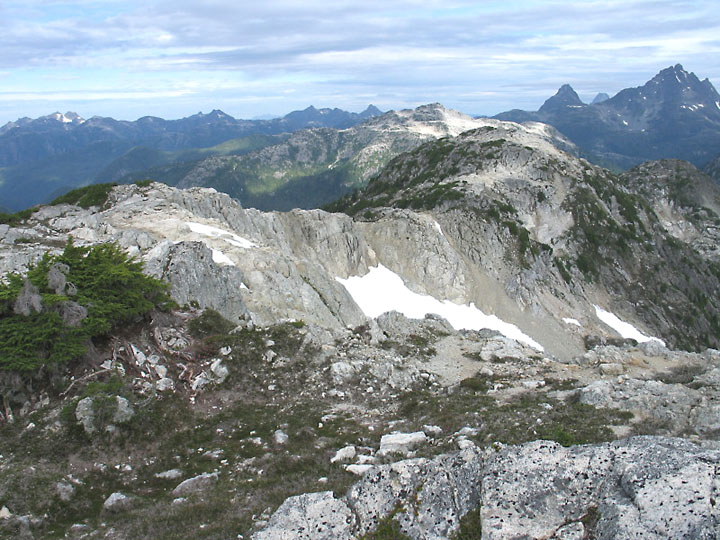
The weather had been quite warm, but some clouds were building as we scrambled up the steep section the next day to a broad, rocky plateau. After a level trail along the west side of a hill we came to a spectacular overlook with a good view of Golden Hinde. Crossing a boulder-strewn basin we passed a young couple coming out. They complained that it had been very hot, but this was about to change. Topping out at a highpoint of 1741m (5712 ft.) we stopped for a snack. From here it was up and down northward along the ridge mostly on bare rock with the trail marked by cairns and worn into the soil where there was some.
Along the ridge there were some challenges with a narrow chimney to descend and a scary step described by Robin. This didn't slow us down much, but we did pass packs down in the chimney. One place we got off route and started down west in a boulder-filled canyon that turned nasty. We were at an impasse when we heard a voice from above shout "Where are you going?" This was not God, I don't think, but some hikers going by although we never did see them. Realizing we may have started down too soon since we hadn't seen any cairns, we backtracked to the ridge an went further north then finally found the correct canyon to descend. The mysterious voice had saved us from trouble.
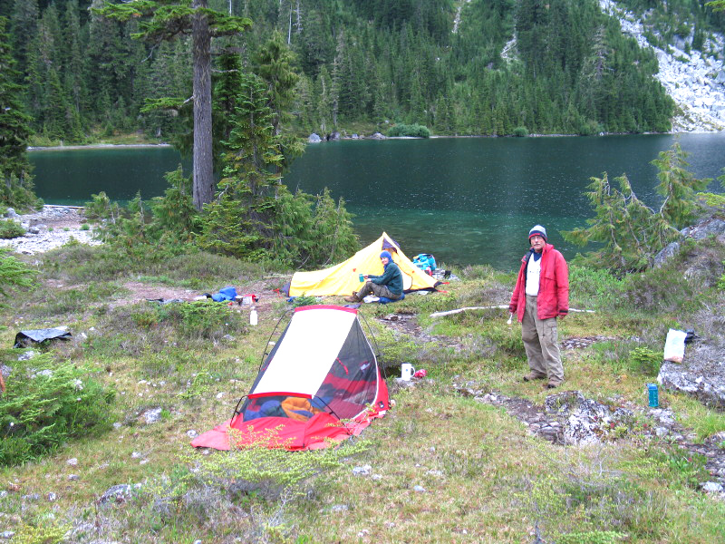
The route was very steep down to the valley and there we were following a worn path in heavy forest to a stream crossing. After this we lost the trail, such as it was, and were groping about in the brush and getting very tired and frustrated. Shelley finally spotted a small red ribbon some distance west so we headed there and then picked up the route as it climbed up to an unnamed lake. This was Burman Lake #3 in Robin's write-up. The going was slow along the lake and we found a good campsite at the north end. (see photo)
Saturday, July 30th, we followed the trail west up by a small tarn on the east side of Mt. Burman and then north to the south end of Schjelderup Lake. The route was difficult along the west side of the lake with talus and steep ups and downs as the trail worked around rock slabs. We needed 2 ½ hours to travel maybe one kilometer to the north end of the lake. Along the way we met five fellows heading out that had come in from Marble Meadows. One fellow said Schjelderup Lake was named for his uncle and directed us to a bronze plaque by a camping area at the northwest end of the lake.
Another steep section brought us up onto the ridge north of Mt. Burman, which we followed down a short distance to a campsite with nearby tarns. That afternoon the clouds that had been building rolled in thick and it started to rain. It came steady too and didn't let up much for 33 hours until midnight Sunday. There wasn't much point in moving so we hunkered down all day Sunday in our tents. Terry's tent did fine, but mine started leaking at the seams and we were scooping out water in a drinking cup. Amazing how much water can leak in through a sewn seam! Fortunately we both had full-length sleeping pads that kept our bags out of the puddle at the bottom of the tent.
While passing time during the storm we thought of our food supply and how much we had. The hike in had taken a day longer than planned and now the storm delayed our climb of Golden Hinde. After all this effort we wanted a chance at the peak. I knew I didn't have enough freeze-dried dinners for many more days so I saved them and had a Clif bar for dinner Sunday night. It appeared we would just barely have enough for several more days if we rationed our supplies.
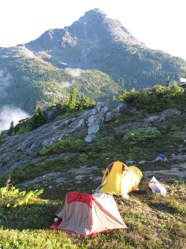
Monday the day looked good. It had stopped Sunday during the night. We estimated it had rained 3 or 4 inches since a small tarn, which was dry when we arrived, was now six feet in diameter with about a foot of water. If food was short, water was certainly not with many new small tarns on the ridge. We headed down to the canyon bottom on the east side of Burman Lake. More steep spots here (see photo) and then we found a faint route up the north side. Soon we were at the moraine lake below the peak. We headed to the east side and tried to find a way up to the upper ridge. We may have gone too far to the right and were discouraged by steep, heather covered slopes that were slick from all the rain. We went back to the moraine lake and couldn't see a way, but I think we gave up too easily. At 1:00 pm we turn back to our camp.
Tuesday, August 2nd, we packed up soggy tents, and headed up the Burman ridge. We dropped our packs and went for Mt. Burman, which didn't look difficult. Working our way around the west side and up the benches we got on the ridge and then made our way south to the summit. On the way we saw more of the ptarmigans we had seen before and made note of their location for the report form we had picked up at the trailhead. There was a cairn but no register so we left one. The weather was perfect and clearer than Monday and was really welcome after all the rain. Picking up our gear we went down past Schjelderup Lake and did the tedious route on the west side and then past the next lake. After getting up the steep section to Phillips Ridge we were tired and the light was fading. We went as far as possible along the ridge and Shelley and I camped just below the scary step, a pretty nice spot. Terry was wiped out and stayed a ridge short of us by himself that night.
Next day, Wednesday, we knew we had to get out since all our food was gone now with barely enough for snack midday. We had been carefully rationing our supplies and each of us ate the last at Arnica Lake. Then down the many switchbacks it was and we reached the trailhead at about 3:30 pm. A bit more effort was needed here before we could leave since my right front tire was flat!
After another night at Ralph River Campground (no bugs this time!) we made it to Campbell River for breakfast. We'll be back next summer for another try at Golden Hinde!
Maps: 1. Buttle Lake 92 F/12, a 1:50,000 scale map covers the entire route. This map is adequate and is cheaper than the 1:20K map.
2. Burman Lake, 092F062 is a 1:20,000 scale map that shows part of the Phillips Ridge and the peak.
Photo page with all of above photos.