|
|
|
|
|
|
Photos of a climb of Mount Kinabalu, 4095.2 meters (13,436 ft.), highpoint of Malaysia
March 1 to 3, 2008
|
|
 |
|
 |
|
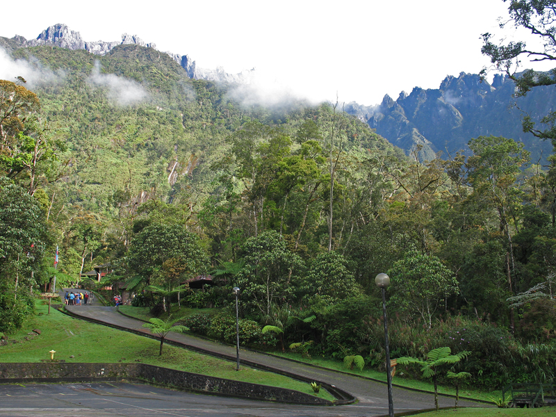
| Mesilau Nature Resort. View looking up at the high peaks of Kinabalu. This is the starting point for the newer Mesilau trail up the mountain. Elevation here is about 1950 m (6400 ft.). |
|
|
|
|
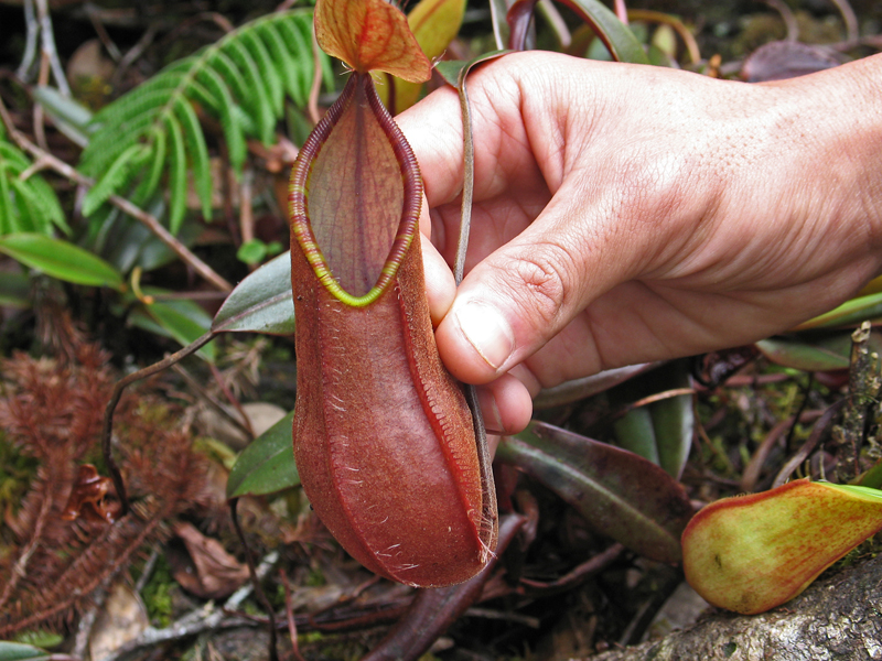
| One of several types of pitcher plants found on the mountain. The plant has a pouch of liquid and insects that fall in are trapped and digested. |
|
 |
|
|
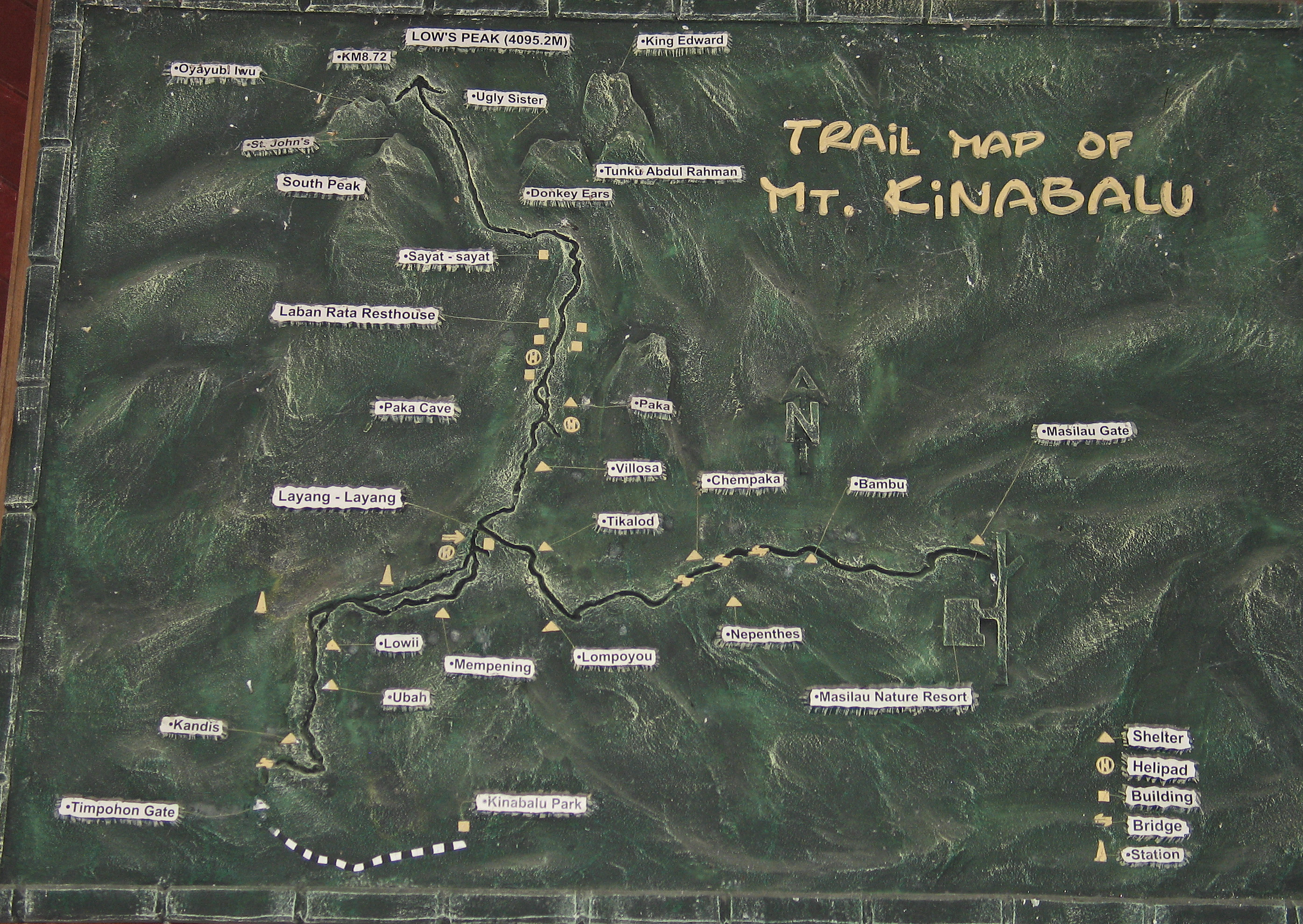
This shows the original trail from the Timpohon Gate and the newer trail from Mesilau Resort. The Mesilau trail is about 2 KM longer and has a extra gain and loss in elevation of about 200 meters before it joins the main trail. It is a scenic trail with fewer people than the main trail. |
|
|
 |
|
 |
|
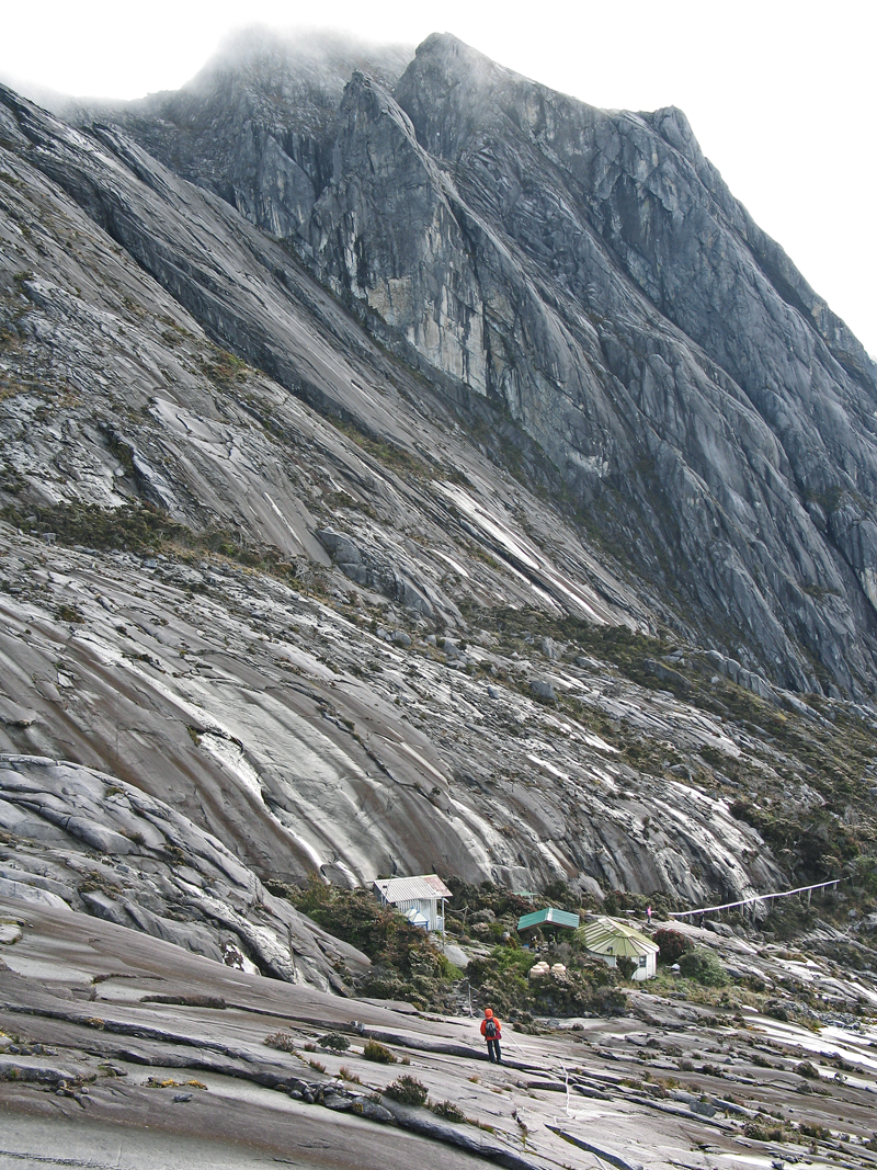
| The large Laban Rata Hut at 3273 meters (10,738 ft.). This has a large dining room and small gift shop that sells postcards and snacks. Has bunks for 56. |
|
|
 |
|
|
Coming down from the summit to the Sayat-Sayat Hut at 3668 m (12,034 ft.). This hut has a ranger that will check your pass in the morning. |
|
|
 |
|
|
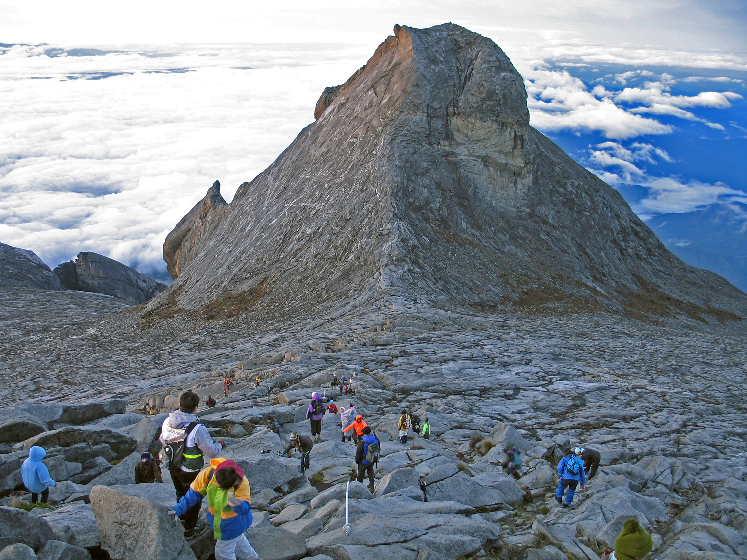
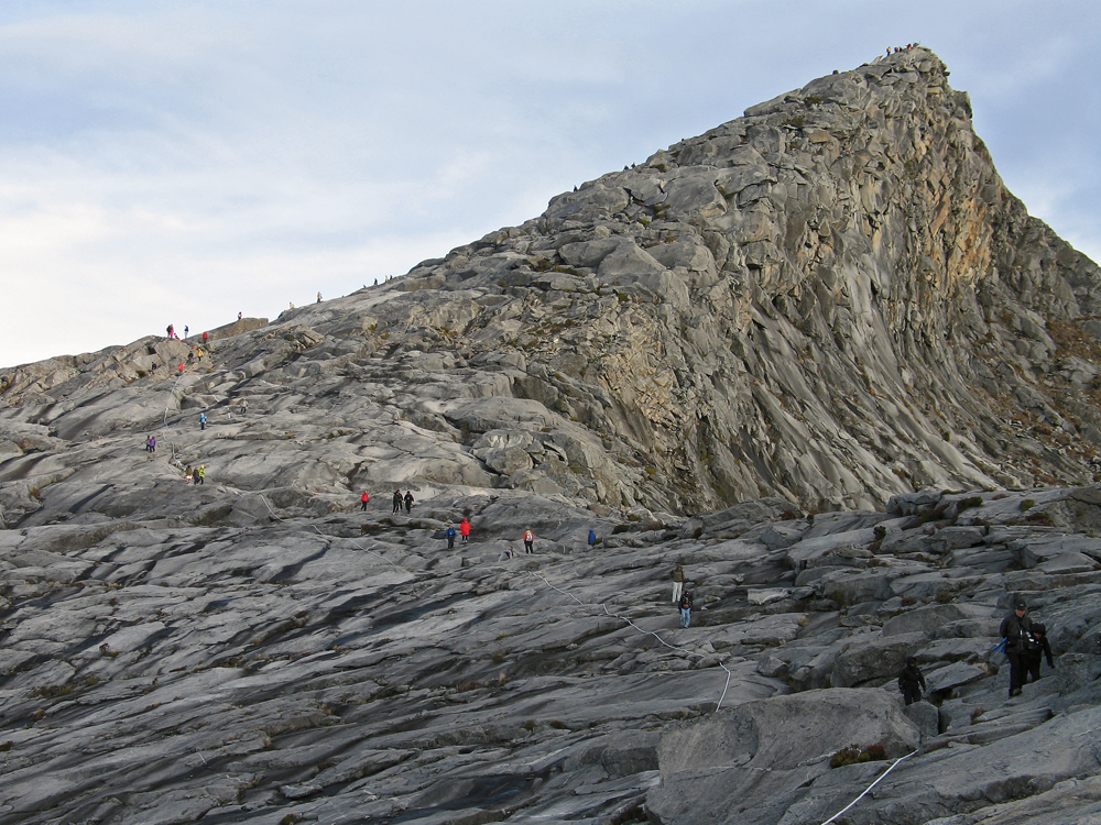
St. John's Peak 4090.7 m (13,421 ft.). Climbers are heading up to Low's Peak which is behind me in this photo. |
|
|
 |
|
|
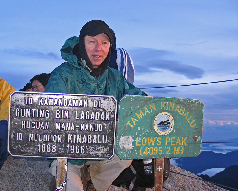
I made it at 6:15 AM after two hours hiking from the hut. The temperature was 2 deg C with light wind. Mobs of people on top all wanting a photo at these signs. |
|
|
 |
|
|
This is Low's Peak at 4095.2 m (13,436 ft.), the highest of several rock pinnacles on the summit of Mount Kinabalu. |
|
Low's Peak is named for Sir Hugh Low, British colonial secretary who made the first recorded ascent on March 11, 1851. He went on to climb the mountain two more times and documented numerous unusual plants.
In the first hundred years there were only 53 recorded ascents. Today the mountain is climbed by over 30,000 each year. |
|
| Mount Kinabalu Trail Map, pdf document (5.6 meg)
Mount Kinabalu Route file, text document
Mt. Kinabalu-Borneo's Rocky Summit, Summit Magazine, March,1967
|
|
|
|
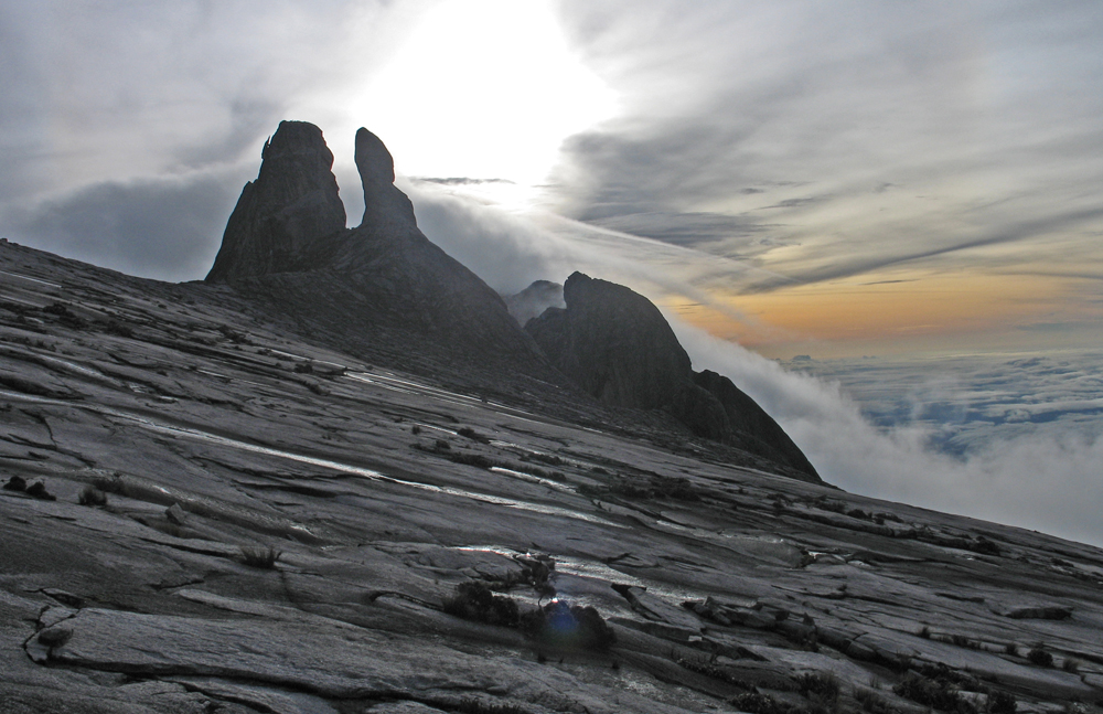
Descending past the Donkey's Ears with the rising sun behind. |
|
|
|
|
|
|
|
|
|
|
|
|
|
|
|
|
|
|