|
|
Cloud Peak, on Big Horn and Johnson County lines, Wyoming
Highpoint of Big Horn and Johnson Counties, Elevation = 13,167 ft. (4013 meters)
The prominence is 7067 ft., ranked #16 of Lower 48 States peaks with >5000 ft. of prominence
|
|
|
 |
|
|
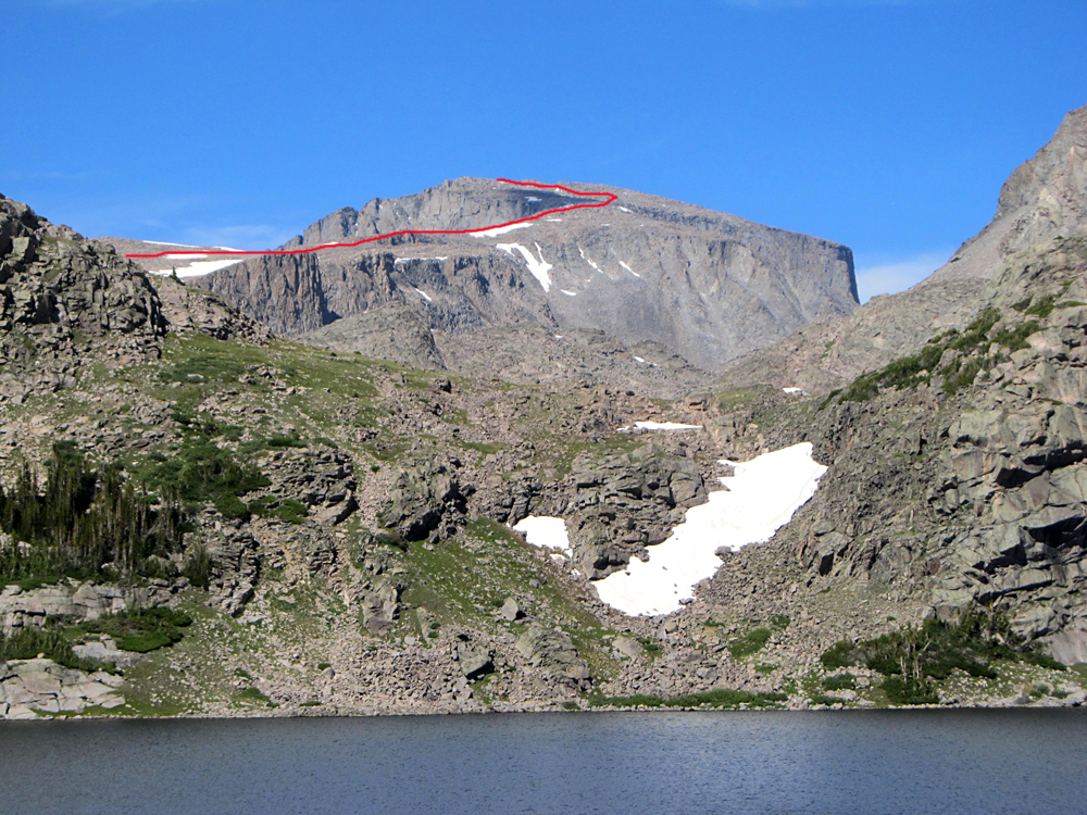
A view of Cloud Peak looking across Lake Helen. The red line shows our route on the upper slopes. Photo by Mark Adrian on July 24, 2014. |
|
|
 |
|
|
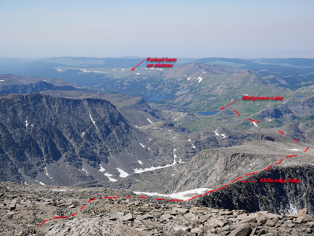
A view looking west on the route down from the summit of Cloud Peak. We camped at Mistymoon Lake and parked up on the Bald Ridge Plateau. We thought the starting point on the plateau would offer a shorter route into Mistymoon Lake than the normal starting point at the trailhead near West Tensleep Lake Campround. We were mislead by a Ranger who said the road up there was "good" so we decided to backtrack to highway 24 and drive up there. After about two hours and 9.7 miles of rough going we got to the trailhead. We concluded it wasn't worth the effort and we really didn't save any time. I will describe how to take this route which requires a four-wheel drive high-clearance vehicle. One slight advantage is that camping is nice up there at 9986 feet away from the crowded campgrounds.
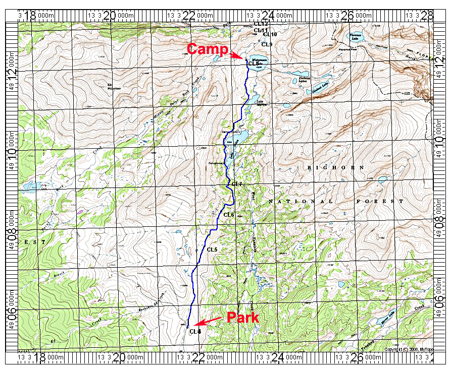
Driving Directions: On highway 16 west of Buffalo turn off on Tensleep Road at a sign for Deerhaven Lodge. This is route 27 and you drive north for 1.1 miles and turn left onto signed route 24. At 3.1 miles turn right onto a fair dirt road going north which is route 411. At about 5.7 miles cross an east-west track. At 6.7 miles there is a cattle guard. In a short distance you will descend and cross a muddy drainage and climb a steep hill. There is some more rough going with lots of boulders until you reach the end of the road at a fence line after 9.7 miles (CL4).
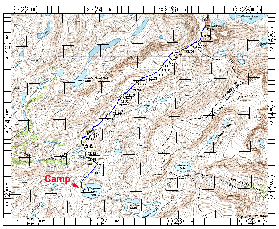
Hiking Route: From the fenceline you continue north across a grassy plateau following old roads. You will descend slightly to a meadow area and pick up the trail that will follow along the slopes to the West Tensleep Creek trail. The hike is 5.6 miles to Mistymoon Lake with about 1000 feet of climbing and 700 feet of loss. From Mistymoon Lake you can following the normal route shown on the map to Cloud Peak. It took us 4 3/4 hours to the summit from Mistymoon. The climb is about 9.8 miles round-trip from the lake with an elevation change of 2600 feet. There is about a 340 foot drop to cross Paint Rock Creek on your way up.
|
|
|
|
 |
|
|
| This map shows the hiking route from the trailhead on Bald Ridge Plateau to Mistymoon Lake. The UTM grid is shown using NAD 27, zone 13. Point CL7 is where the trail joins the regular trail from West Tensleep trailhead. |
|
 |
|
| This map shows the route to Cloud Peak summit from the campsite at Mistymoon Lake. Point CL13 is a stream crossing. The UTM grid is shown using NAD 27, zone 13. Two GPS waypoint files are available, one using the gpx format for use with the free program EasyGPS. The other is for use with Terrain Navigator by MyTopo Company. This file has notes that will appear on many GPS screen in the notes area. Using EasyGPS the notes do not transfer to the GPS.
CloudPk.gpx For use witth EasyGPS
CloudPk. mxf For use with MyTopo Terrain Navigator
|
|
|
|
|
|
|
|
|
|
|