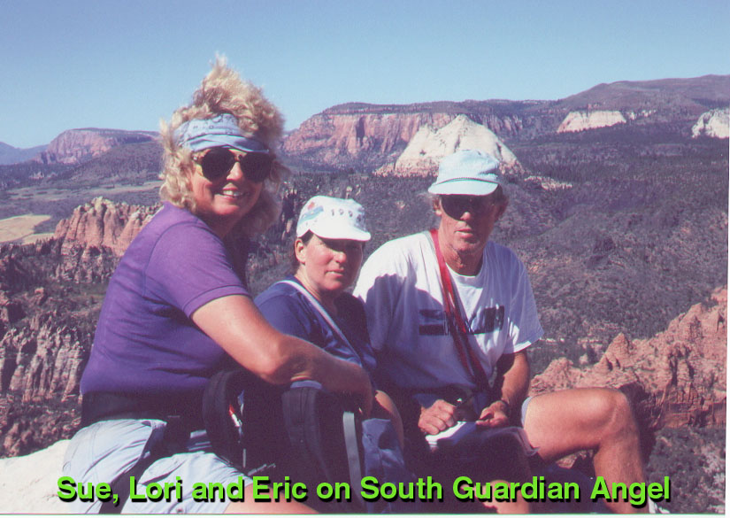
South Guardian Angel, Cross-Canyon Bushwack, October 9, 1999. By Richard L. Carey
After a long drive from San Diego, Sue Holloway and I arrived at the Lava Point Campground in Zion at about 9:30pm on a Friday night. We parked next to Eric and Lori Beck who were asleep in their truck. Next day we got an early start at 6:00am at the usual trailhead by the switchback on the Kolob Reservoir Road. This is the start for North Guardian Angel, but since camping in the Subway has been stopped by the Park we decided to try SGA from here by the cross-canyon route.
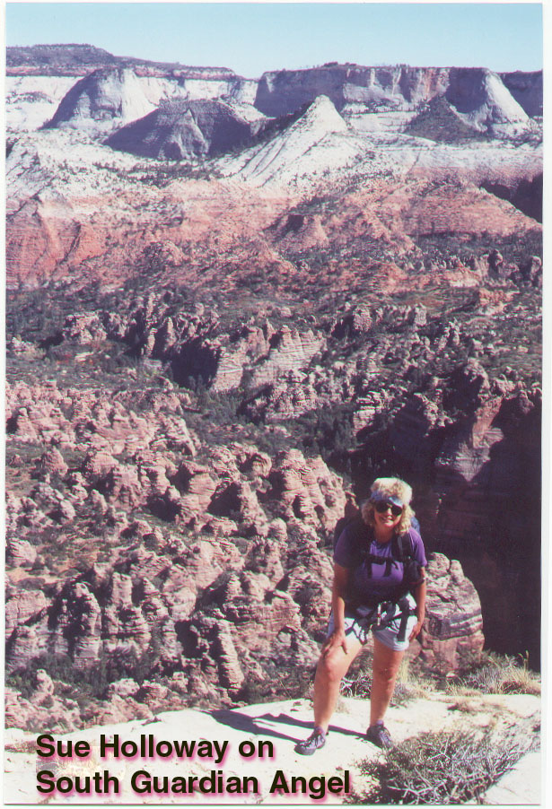
The open pine forest was blackend and still smoking in areas due to a "prescribed burn" by the park. Following the good trail south between the twin Northgate Peaks we reached the top of the ridge that would be our route down to the bottom of the Great West Canyon. Sue had done the route before and we thought we might avoid the problems she had in reaching the bottom, but this was not to be. The ridge is easy at first and then divides into numerous, brush-filled canyons. Several forays through the brush led to the top of 200 foot cliffs. Sue thought we should move east and this was correct when we finally found a route down to a lower terrace.
It still looked a long way down and after floundering for a bit Sue found a steep ridge that was the key. We came out at the stream exactly opposite the normal climb-out point on the south side which is a hundred feet or so east of the Slime Traverse. It had taken four hours and the cool canyon bottom was a welcome break.
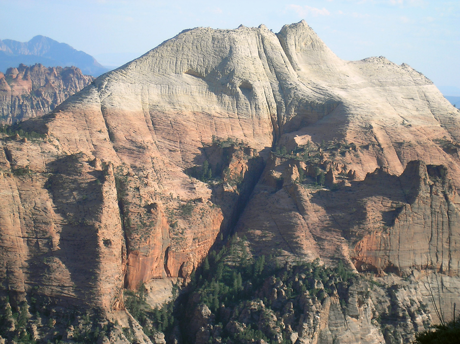
From here the normal route to SGA is followed and we reached the summit at 1:30. Sadly the old register has been removed and a new one placed by a group in early May. I don't know why old registers can't be left on the summit for others to enjoy! Retracing our path we reached the canyon bottom at 4:30. The weather was near perfect, but we had to ration our water and most of us were out well before the end of the hike. The climb out was steep through the brush and we reached the trailhead at 7:30 in the dark.
The route had taken us 13 1/2 hours which is slower than the reported 11 hours of a group on May 23rd. This new route makes the South Guardian Angel one of the hardest peaks on the Desert Peaks List, right up there with Picacho del Diablo.
I measure 9.5 miles round-trip for this route with a gain of 3100 feet. We ducked the route down better than it was, but it still may be tricky finding the way. I logged waypoints with my GPS which may be of help to future hikers. The easting and northing values can be plotted on the topo to show the route if you don't have a GPS. SGA route file. SGA Map