Milford Needle, Beaver County, Utah
On BLM land, Elevation = 9582 ft. (2921 meters)
|
Milford Needle, Beaver County, Utah
On BLM land, Elevation = 9582 ft. (2921 meters) |
||||||||||||
|
||||||||||||
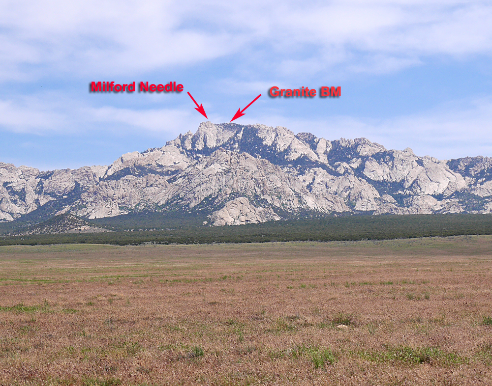
| A view looking at the west side of Granite Mountain from the approach road. The summit with Granite benchmark is 9580 ft., but the true high point is a rock pinnacle to the north called Milford Needle. It is two feet higher at 9582 ft. Photos here are from a climb of Granite and the Needle on June 5, 2015. | ||||||||||||
|
||||||||||||
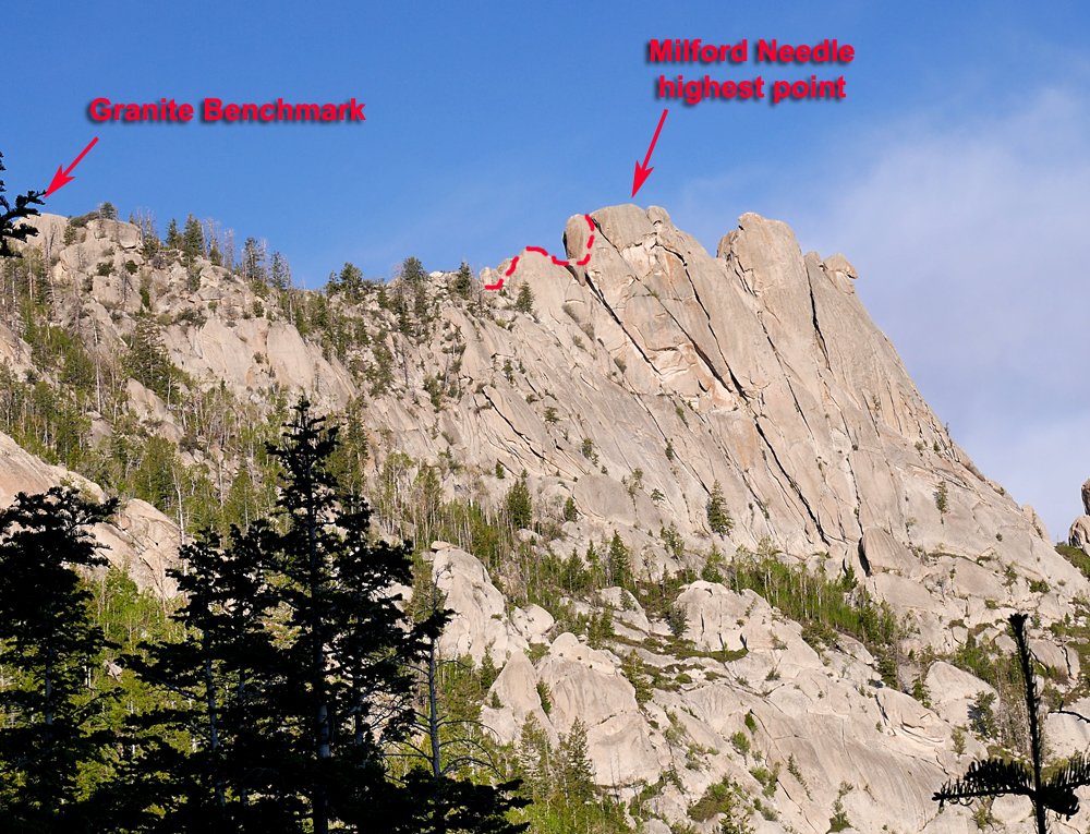
| Looking up at the Needle from the route up the canyon on the east side. There is no trail and only the barest signs of a path lower down. It is a tiring climb up 2500 feet to the area of the summit boulders with lots of deadfall and brush. It is best to go to the south side and ascend where the benchmark is and then traverse north to the Needle. There is a good description of the climb by Ben Stokes at Peakbagger.com Ken Jones provides a good GPS track of the route to the summit area. Ken Jones' track. | ||||||||||||
|
||||||||||||
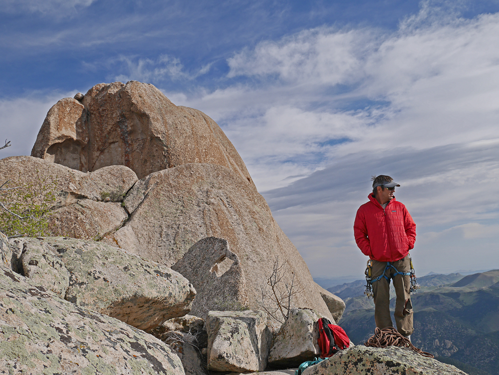
| Guide Todd Passey with gear at the start of our climb. The company he guides for is at: www.inthecompanyofguides.com. | ||||||||||||
|
||||||||||||
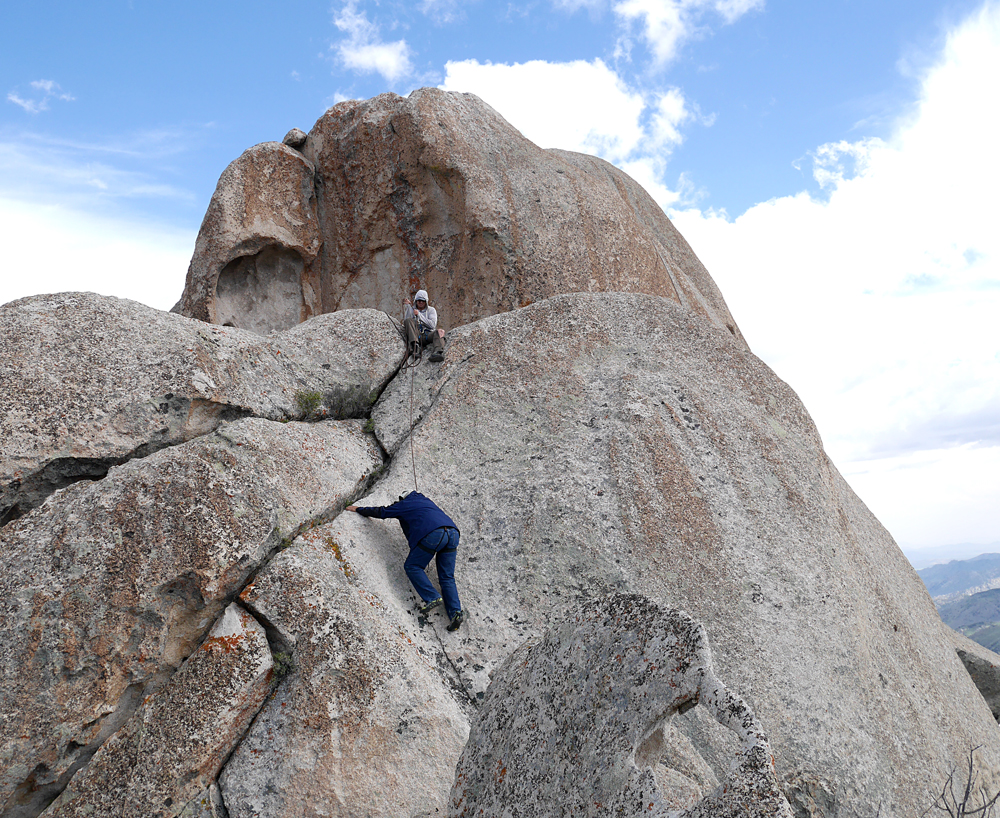
| Todd belaying Andy Martin on the first part of the climb. Behind where Todd is sitting is a short down climb along the ridge of the boulder to a platform where the climb of the main boulder starts. | ||||||||||||
|
||||||||||||
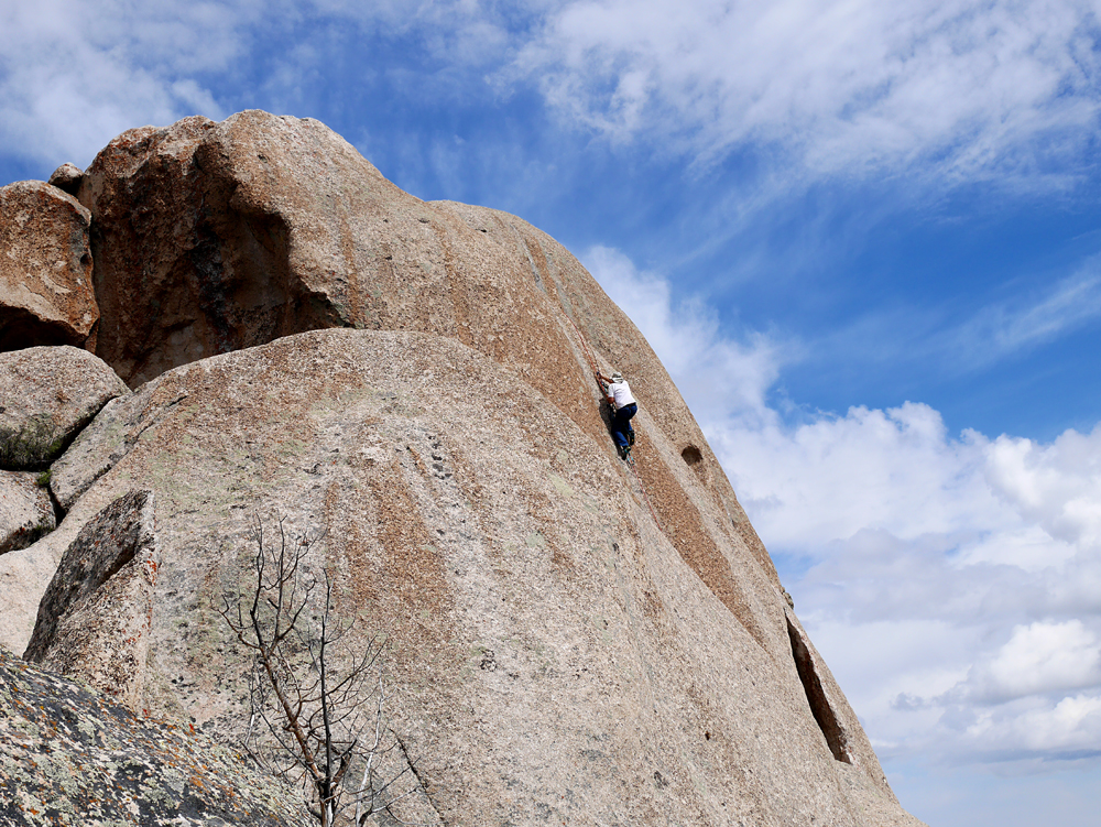
| Andy using Jumar ascenders to climb up about 50 feet to the top of the main boulder on the Needle. I found this part quite difficult. | ||||||||||||
|
||||||||||||
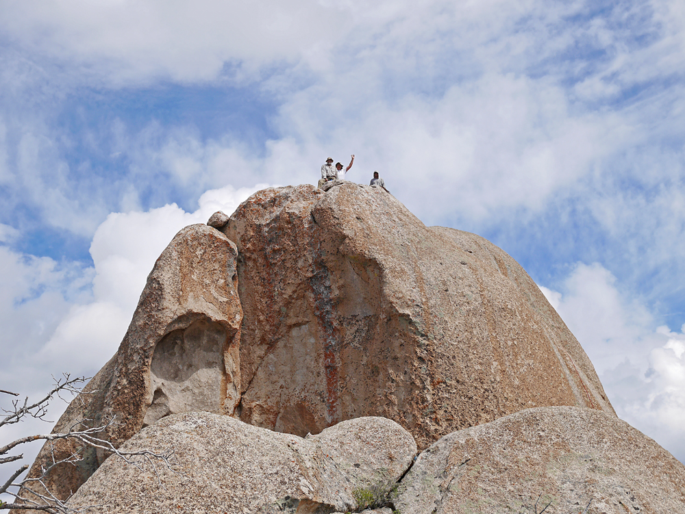
| Mark Nichols, Andy Martin and Todd Passey on top of the Milford Needle. | ||||||||||||
|
||||||||||||
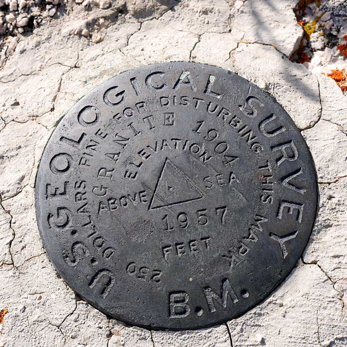
| Benchmark GRANITE at the lower south summit. Originally placed in 1904. Datasheet | ||||||||||||