Indian Peak, Beaver County, Utah
Elevation = 9790 ft. (2984 meters)
Located on the boundary of BLM land and the Indian Peaks Wildlife Management Area
|
Indian Peak, Beaver County, Utah
Elevation = 9790 ft. (2984 meters) Located on the boundary of BLM land and the Indian Peaks Wildlife Management Area |
||||||||||
|
||||||||||
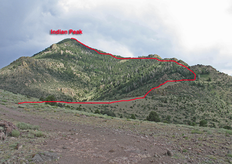
| A view of the north side of Indian Peak with our climbing route. This route works fairly well see details below. The prominence for this peak is 3660 feet. | ||||||||||
|
||||||||||
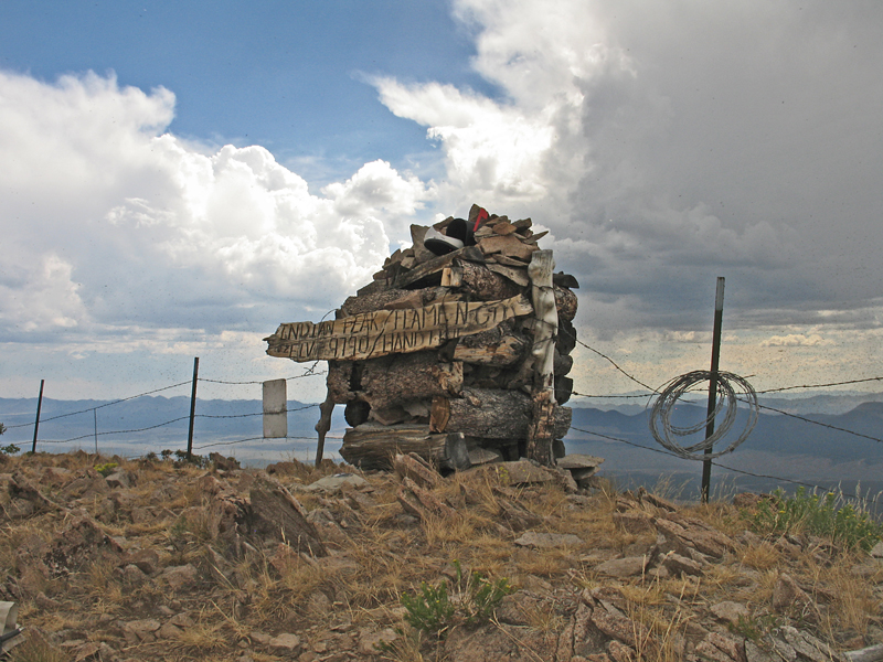
| The summit cairn on Indian Peak. When we visited there was a huge swarm of fying ants around the cairn. Getting to the register in the mailbox was nasty! | ||||||||||
|
||||||||||
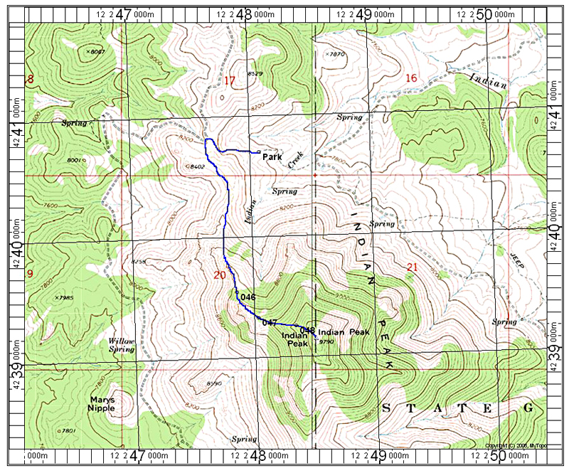
| A topo map showing our route on the north side. There is a good report on the drive-in to this peak by Dean Molen on SummitPost. There is a north-south fence on the boundary line that runs right through the summit. At the boundary where the road loops back south there is a cattle guard. The Jeep road going west from there is rough with deep ruts. We went about 0.3 miles further and parked at about 8100 feet as shown. We walked the road to a crest and headed south on a track then up to the ridge (point 046). There is some sidehilling on talus, but otherwise the route is good. The distance is about 3.8 miles round-trip with a gain of about 2000 feet due to some dips. It took us 1 1/2 hours to reach the top. The above map has the UTM grid using NAD27 datum, zone 12. 7/2013 RLC | ||||||||||
|
||||||||||
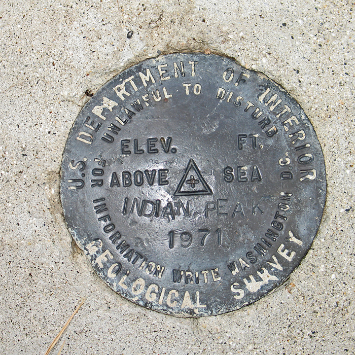
| The benchmark disk at the summit. The datasheet for this peak is incomplete with limited information. JO0582 | ||||||||||