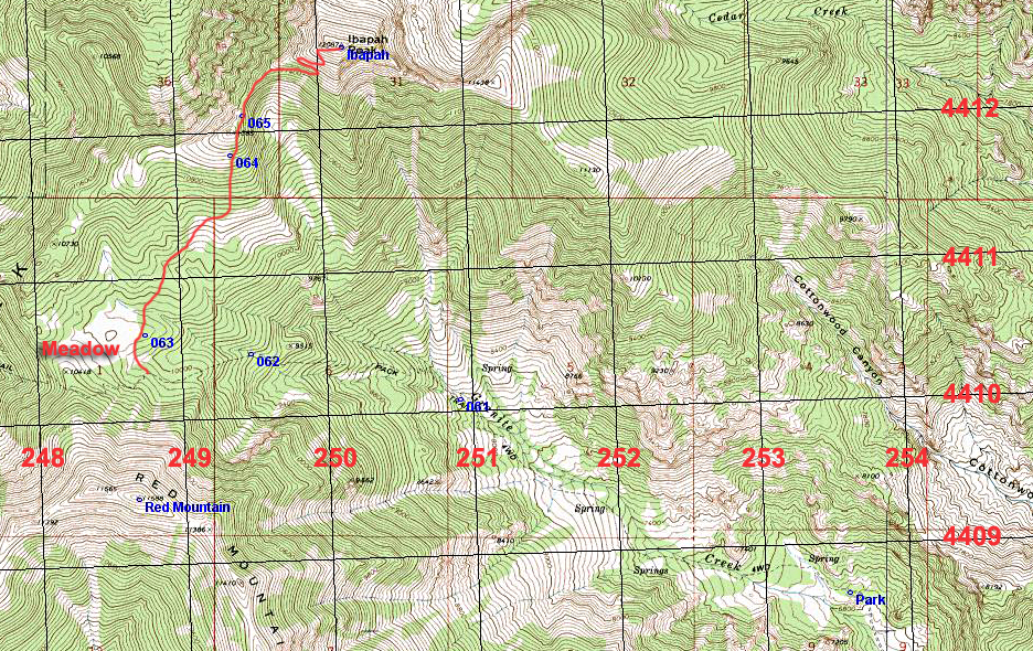
Ibapah Peak, Juab County, Utah
Highpoint of Juab County, Elevation = 12,092 ft. (3686 meters)
|
Ibapah Peak, Juab County, Utah
Highpoint of Juab County, Elevation = 12,092 ft. (3686 meters) |
|||||||||||||
|
|||||||||||||
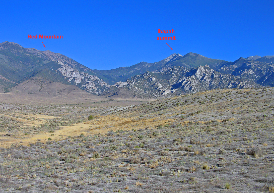
| A view looking west at Ibapah Peak and Red Mountain with the canyon that has Granite Creek in the middle. This is a big peak in far western Utah. The hike is mostly on decent trails and is most rewarding. It is best done after June to avoid snow on the upper slopes. There are some good reports on this peak at the County Highpoints site. | |||||||||||||
|
|||||||||||||
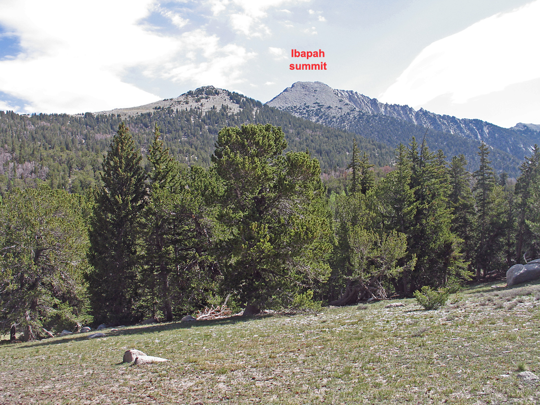
| A scene looking north from the meadow at 10,160 feet. From here head toward the summit and pick up some cairns and a use trail to the right of peak 11,385 feet. The trail can be followed to the right side of this peak all the way to the top. | |||||||||||||
|
|||||||||||||
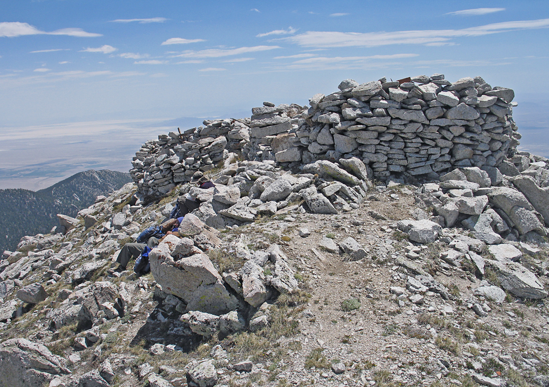
| A rock shelter at the summit. A register book in a plastic bag was found in June, 2012. The peak could really use a large box to protect the register. | |||||||||||||
|
|||||||||||||
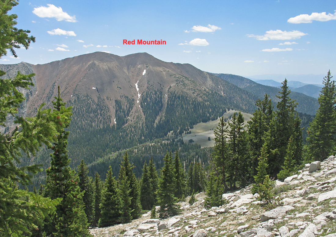
| A view on the descent from Ibapah looking south at Red Mountain which appears to be red cinders in contrast to the white granite of Ibapah. Red Mountain is 11,588 feet. The trail goes through the meadow at 10,160 feet at the pass. | |||||||||||||
|
|||||||||||||
| Drive 5.8 miles into Granite Canyon to reach the trailhead. The last 0.7 mile past the camping area is rough, four-wheel drive. The road is blocked at Park where we camped. It is a sloping area and not the best for camping. Higher up on the trail one can find good water at 9,600 feet and also just below the pass. The hike has about 5,100 feet of gain and it took us 5 hours and 20 minutes to the top and about 4 hours down. The UTM grid lines on the above map are using NAD27 datum. | |||||||||||||
|
|||||||||||||
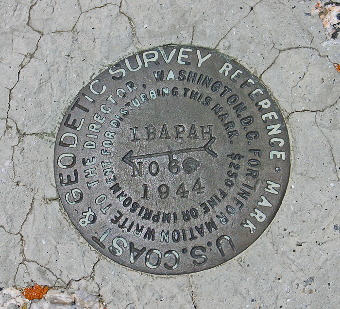
| Reference Mark #6 is the only benchmark found other than the steel pin at the summit. The peak was first surveyed in 1889. Datasheet. | |||||||||||||