Trap Mountain, Brewster County, Texas, Elevation = 4125 ft.
Located in Big Bend National Park
|
Trap Mountain, Brewster County, Texas, Elevation = 4125 ft.
Located in Big Bend National Park |
||||||||
|
||||||||
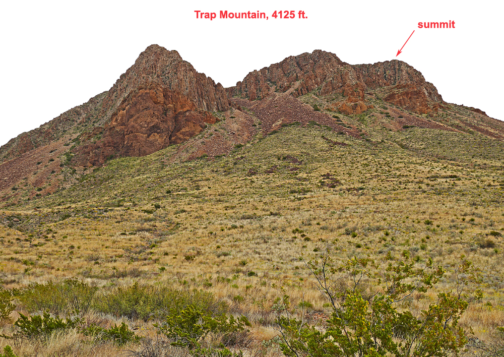
| This view is looking east at Trap Mountain from the highway to Castolon. The mountain is close to the turnoff to the Mule Ears Viewpoint. It is not named on the Big Bend Park visitor map. We hiked up the obvious gully in the center which had quite a bit of tedious talus. | ||||||||
|
||||||||
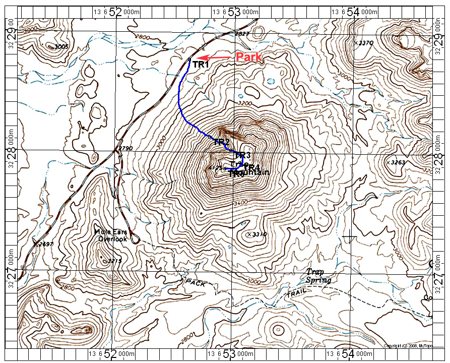
| The blue line shows our climbing route to Trap Mountain summit. We started from an exhibit area with a plaque about Goat Mountain which is point TR1. We went up the gully which starts at about point TR2. After some scrambling on large talus we reached the upper slopes and turned south. The top is smooth and easy going. This route is 2 miles round-trip with a gain of about 1280 feet. It took about 50 minutes to reach the top. The east side of the mountain might be a bit easier. You could start from the Mule Ears Viewpoint parking area and follow the trail east to about near Trap Spring then head up the slopes east of point 3310. This looked talus-free and may be easier, but a bit longer than our route. The above map has the UTM grid using NAD27 in Zone 13. 3/15 RLC GPX file: TrapMtn.gpx | ||||||||