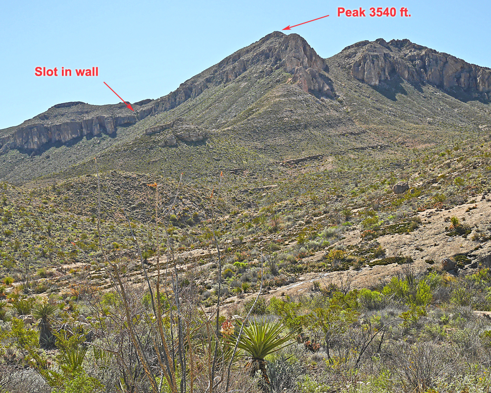
Peak 3540, Brewster County, Texas, Elevation = 3540 ft.
Located in Big Bend National Park
|
Peak 3540, Brewster County, Texas, Elevation = 3540 ft.
Located in Big Bend National Park |
||||||||||||
|
||||||||||||
| This view is looking west at Peak 3540 from the south fork of the Marufo Vega trail at point T15 shown on map below. The slot in the wall is a good way to get past the cliffs and reach the upper slopes. From point T15 to the summit is cross-country with no trail. The prominence for this peak is 800 feet. | ||||||||||||
|
||||||||||||
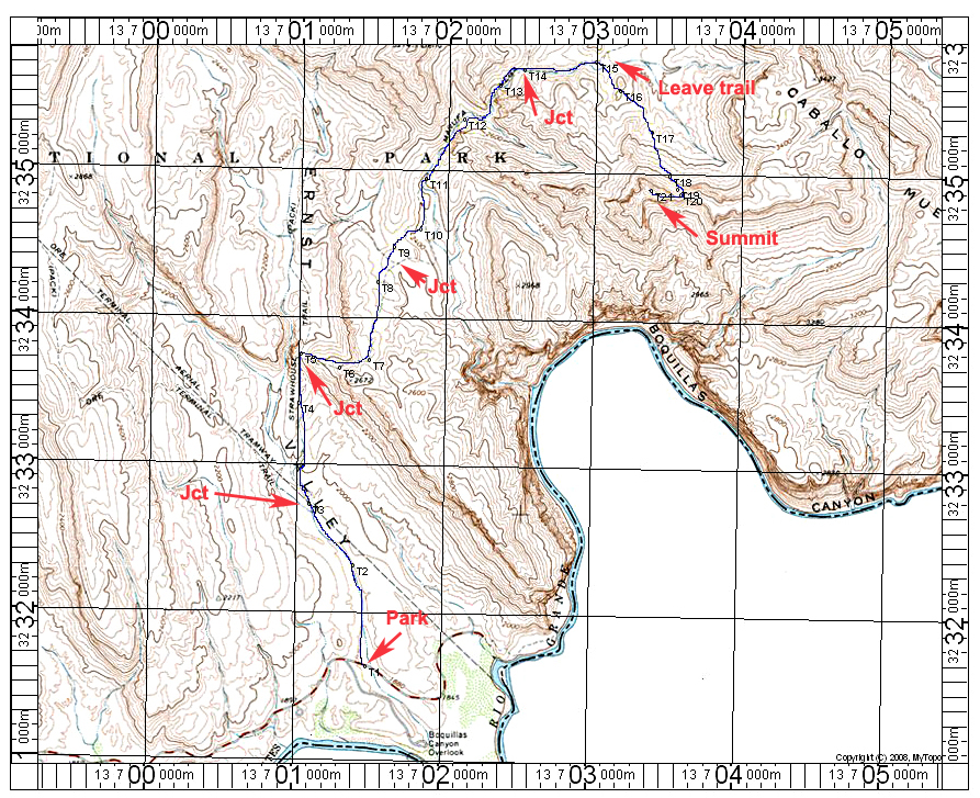
| The above map shows a hiking route to the summit of Peak 3540 ft. which is about the highest peak in this remote area of Big Bend Park. The route makes good use of the Marufo Vega Trail which is well marked and easy to follow. The sign below is at the trailhead at point T1. You can get to this point by driving east on the paved road to Boquillas Canyon Overlook. The turn is 1.2 miles north of the Rio Grande Campground. Follow the road for 3.0 miles to the trailhead which is a very short distance past the spur road to the overlook. Hike north on the trail which is in a broad wash to point T3 with a junction. Go right here. The trail climbs up to a junction at T5 where you go right up a steep, stone-filled section to higher ground. The trail wanders across open country with another junction near T9. Go right heading into a canyon. At T14 go right on the South Fork Trail. At T15 you get a good view of the peak. Leave the trail and head toward the slot at T19. Once through the slot head right toward the summit. This route is about 10.2 miles round-trip with a grain of about 2200 feet counting some of the drops along the way. Be sure to have plenty of water. The above map has the UTM grid using NAD27 in Zone 13. 3/15 RLC A GPS file is available for this route: Peak3540.gpx | ||||||||||||
|
||||||||||||
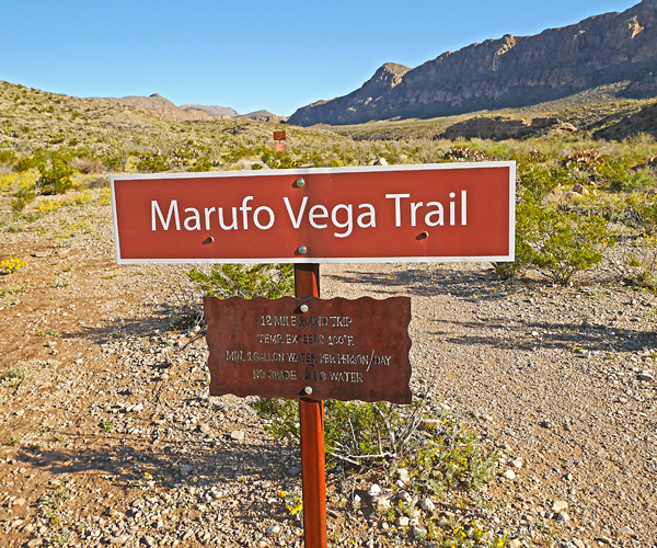
| A sign along the highway at point T1. The Marufo Vega Trail is a 12 mile loop that goes to the river. The hike to the peak uses only a portion of this trail. The trail is well marked with signs at each junction. At junction T3 the left trail goes to the old Ore Terminal. At junction T5 the left branch goes north to the Straw House. | ||||||||||||
|
||||||||||||
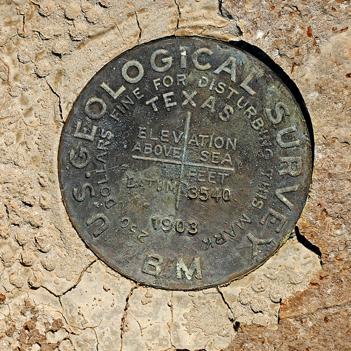
| The benchmark disk at the summit stamped with the elevation, but no name. There is no USGS datasheet for this or for Bend BM which is north of point T12. | ||||||||||||