Sirens Peak, San Diego County, California, Elevation = 4401 ft.
In the Anza-Borrego Desert State Park

|
Sirens Peak, San Diego County, California, Elevation = 4401 ft.
In the Anza-Borrego Desert State Park |
|||||||||||
|
|||||||||||
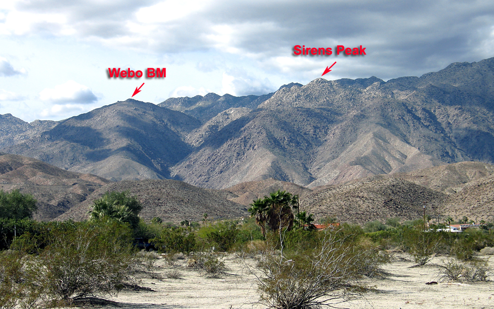
| A view looking west from Borrego Springs showing Sirens Peak and also Webo Benchmark. | |||||||||||
|
|||||||||||
| Another view of Sirens Peak looking north from Webo Benchmark. The name is unofficial and on the topo map it is shown as spot elevation 4401 feet. | |||||||||||
|
|||||||||||
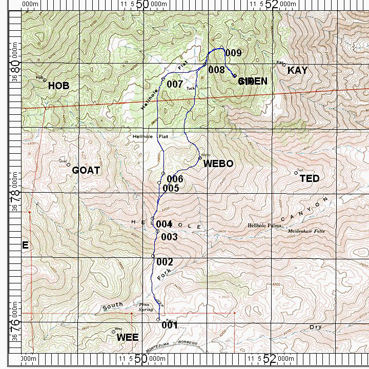
| The map shows a hiking route from the Pena Spring trailhead, point 001. The route crosses Hellhole Canyon in a steep descent then a long climb up to Hellhole Flat. Sirens Peak is best climbed from the north as shown. On the return you can go to Webo BM. This is a strenuous hike of 7.6 miles round-trip with 3500 feet of gain and 3500 feet of loss. Allow about ten hours to complete it. The UTM grid using NAD27 datum is shown on the map. Zone 11S. | |||||||||||
|
|||||||||||
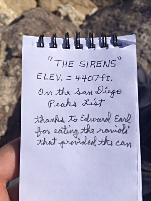
| I left a new book and register can on the summit on February 2, 2013. I obtained many cans from Edward Earl as noted in the book. Photo by Laura Newman who climbed the peak on January 18, 2015. | |||||||||||