Located in Anza-Borrego Desert State Park
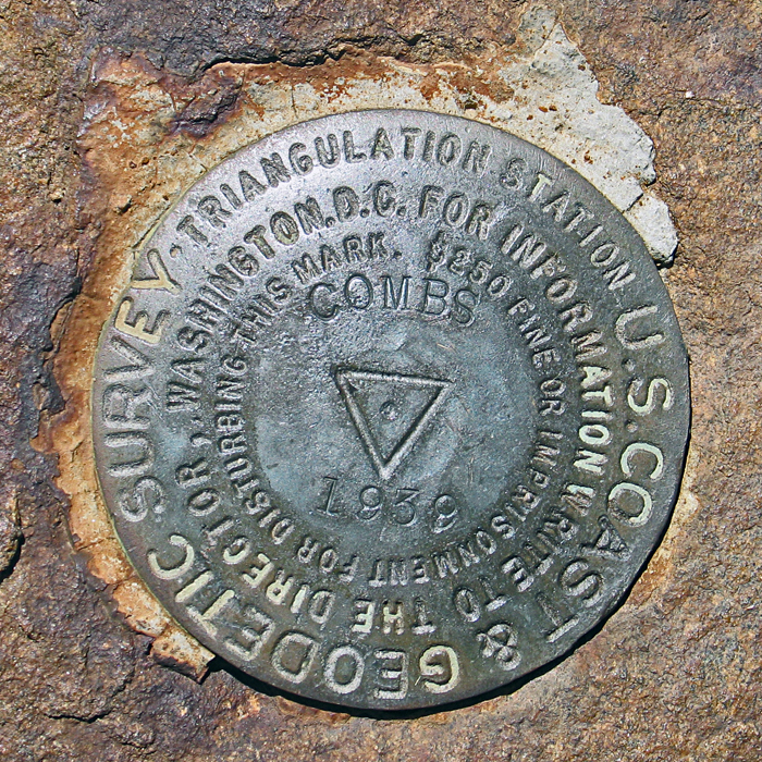
The peak is named for local pioneer miner Jim Combs. According to longtime area resident John Wentworth he established "Combs Camp" just south of the peak when homesteading was opened in 1915. Name first appears on the 1960 Bucksnort Mountain 7.5 min. map. (Quirarte)
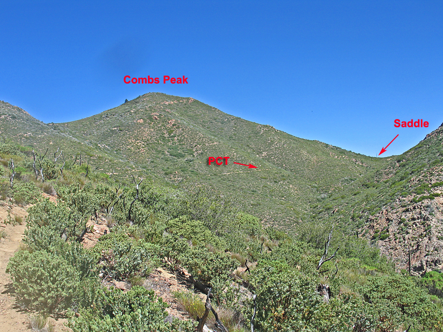
The peak is located in the remote northwest corner of Anza-Borrego Desert State Park and is about 1/4 mile west of the Pacific Crest Trail. The area is open for hiking and no permits are required.
To reach the peak take highway 79 northwest from Warner Springs for 10.4 miles and turn right (E) onto paved Chihuahua Valley Road. Reset your odometer and travel east over a hill after a few miles to the valley with its scattered homes. At about 6.5 miles go straight onto a dirt road as the pavement makes a wide turn to the right. There will be two nearly parallel dirt roads and you want the one on the right called Lost Valley Road which goes to a Boy Scout Ranch. Note the following mileages on this good to fair dirt road: at 1.6 miles go through a gate which is almost always open, at 2.9 miles a sign indicates you are entering the State Park , and at 4.8 miles park alongside the road at a pass with signs on boths sides of the road marking the Pacific Crest Trail. Start the hike here heading north on the PCT. After about 45 minutes you will reach a prominent saddle with good views to the east and north. Leave the trail here (UTM: 537130E, 3695100N, NAD27) where there is usually a cairn marking the start of a use trail heading west to the summit. Follow this clipped trail through the chaparral to the top which takes about another half hour. There are a couple of easy boulders to scramble over on the route. The one-way distance is 1.8 miles with an elevation gain of 1150 ft. Allow 1 1/4 hours for the ascent and about 1 hour to return. Checked and updated 6/14 RLC