|
Toiyabe
Peak is an unnamed 2000 ft. prominence peak in the northern part of the
long Toiyabe Range in central Nevada. We climbed this in July, 2016 and
used the track by Dennis Poulin as a guide which works well. The track
can be found on the Peakbagger.com website. A track by Ken Jones is
quite similar. Dennis' track. We
followed the track which is 5.4 miles one-way with a gain of about 3800
ft. counting a drop on the summit ridge. Following the track it took us
4 1/2 hours for the ascent and 3 hours down. On the way down we
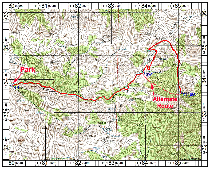
thought the alternate route shown on the above map with a dashed line
would work. It is about one mile versus 2.5 miles to the top using the
track. The terrain is steep, but open with no rock bands or other
problems.
The
above map has a one-kilometer UTM grid using NAD27. Point SW is a
switchback in a canyon where one would leave the trail and head up the
slope. UTM there is: 483950E, 4334190N, in UTM Zone 11. The gain is
about 2000 ft. to the summit on the alternate route. 8/16 RLC
|
|
|