Table Mountain, Nye County, Nevada
In Toiyabe National Forest, Elevation = 10,894 ft. (3321 meters)
Highpoint of the Monitor Range
|
Table Mountain, Nye County, Nevada
In Toiyabe National Forest, Elevation = 10,894 ft. (3321 meters) Highpoint of the Monitor Range |
|||||||||
|
|||||||||
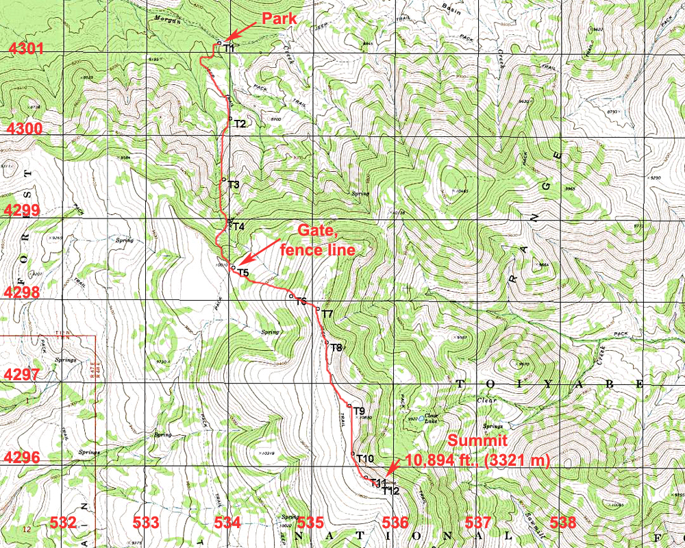
| The above topo shows the route to Table Mountain from the trailhead and parking area at point T1. The trailhead is reached on good roads in Morgan Canyon and is 8.0 miles east of Monitor Valley Road. From the trailhead hike south on an old road which turns into a trail and ascends up to a ridgetop at point T5. Here there is a gate in an easy-west fence line. Go through the gate and turn left going cross-country up easy slopes to the ridge. Do not follow the trail from the gate which goes to the southwest. Along the ridge it is an easy walk of 1.7 miles to the summit which has a large cairn. This route is about 9.6 miles round-trip with a gain of about 2800 feet. It took us 3 1/4 hours to reach the top. Overall this is a very pleasant hike in good weather with great views along the ridge top. There is a very good chance of seeing elk on the mountain. The map has the UTM grid using NAD27 in zone 11. A GPS waypoint file for this route is available: TableMtn.gpx | |||||||||
|
|||||||||
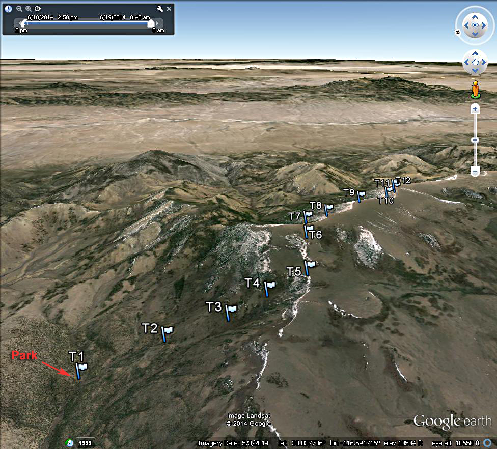
| A Google Earth image looking east at the hiking route. Most of the elevation gain is from the trailhead, T1 to the ridgetop at T5. | |||||||||
|
|||||||||
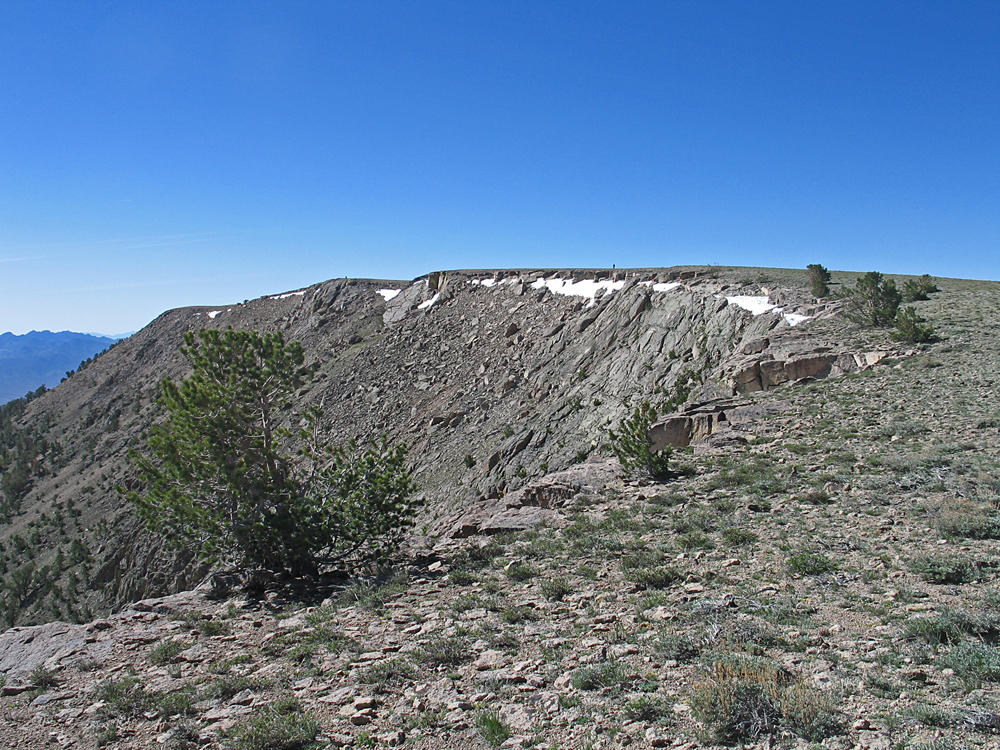
| A view looking south from about point T9. The summit is the last high mound on the left. The primary benchmark could not be found and is probably under a large cairn. RM#1 and RM#2 which are unstamped except for the date can be located. Datasheet. | |||||||||