Sheep Peak, Clark County, Nevada
Elevation = 9750 ft. (2972 meters)
In the Desert National Wildlife Refuge
|
Sheep Peak, Clark County, Nevada
Elevation = 9750 ft. (2972 meters) In the Desert National Wildlife Refuge |
||||||||
|
||||||||
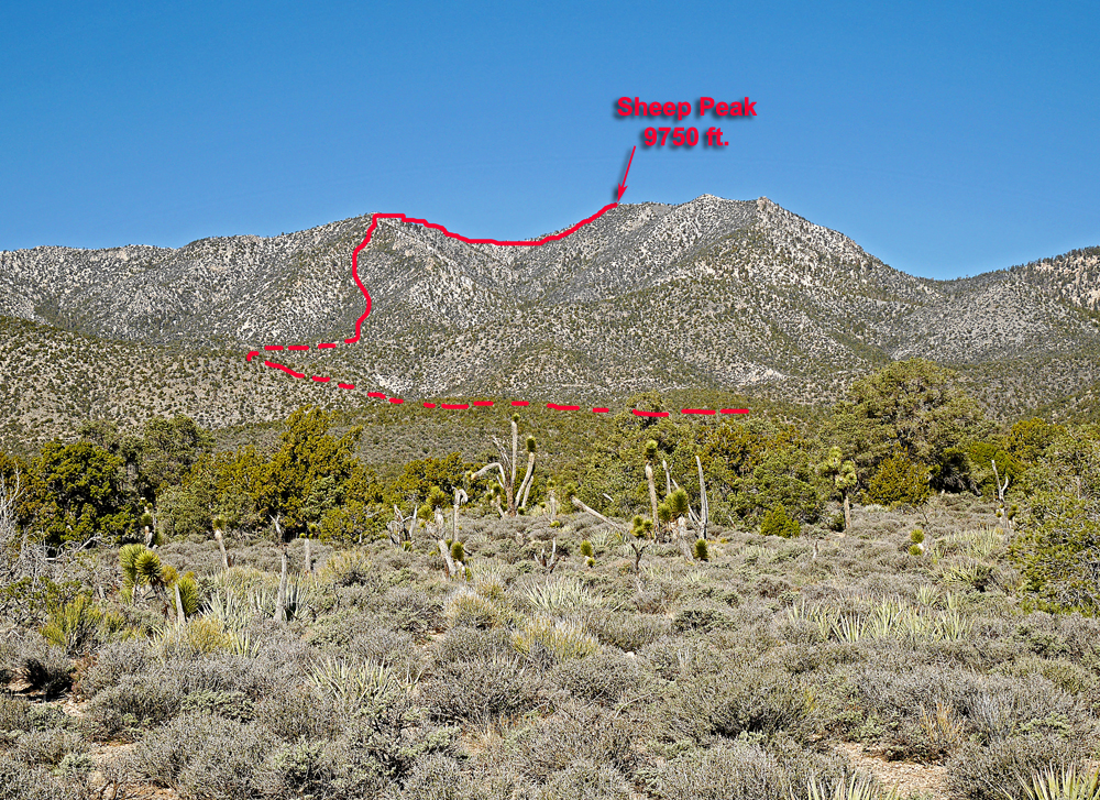
| Sheep Peak is in the Sheep Range about 5 miles south of Hayford Peak. It is the second highest peak in the range after Hayford. It can be climbed from either west or east sides. I describe our route from the east side starting at Pine Nut Camp at 6700 ft. The campsite is reached by taking the Mormon Well Road from the visitors center. Follow the rough road about 16 miles east to the turn on your left to Pine Nut Camp. It is another 5.7 miles on a fair to poor road where high-clearance is needed. The photo above is looking west at the peak and the red line shows the approximate route. | ||||||||
|
||||||||
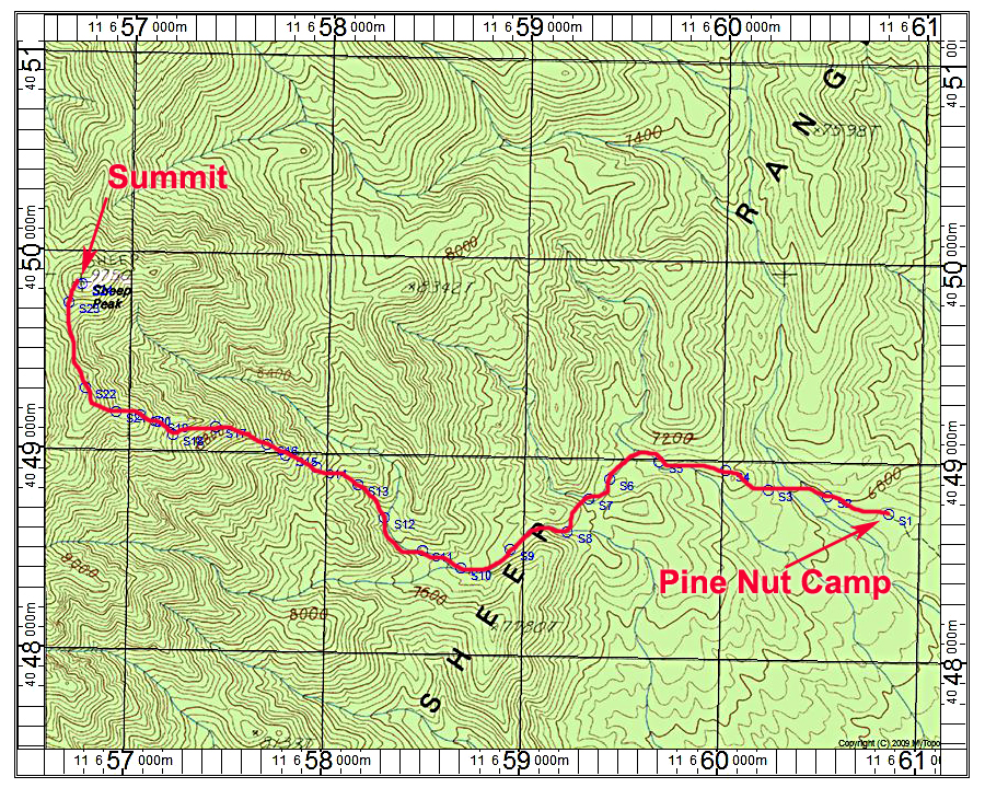
| The above map shows our route to the summit. The map has a one kilometer UTM grid using NAD27 datum. This route has no trail. Head west from the last parking area and descend through the forest to a large wash below point S2. Ascend a ridge and cross over into another wash at S5. Follow this to point S7 and cross over to another wash heading west. At S10 go right into a small canyon. Leave the canyon at S12 and head up the ridge. Higher up move left into a ravine which gets steep at times. Stay left of some cliffs on the ridge and head to a flat area at S21. Then go over a small peak and descend to a final saddle and up the slopes to the summit. This route is about 7.4 miles round-trip with a gain of about 3300 ft. It took us about 4 hours up and 2 1/2 hours down. A gpx file for this route is available. SheepPk.gpx 3/16 RLC | ||||||||