Pilot Peak, Elko County, Nevada
Elevation = 10,720 ft., 3268 meters
|
Pilot Peak, Elko County, Nevada
Elevation = 10,720 ft., 3268 meters |
||||||||||
|
||||||||||
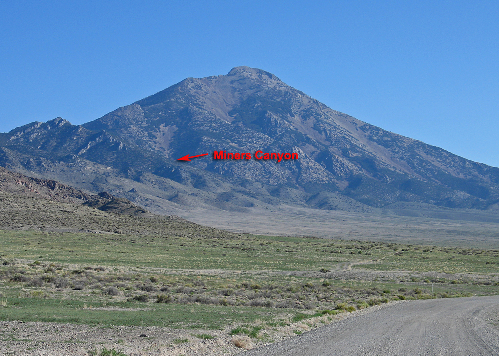
| This is the south side of Pilot Peak viewed from the road driving north from Wendover through Leppy Pass. The climb I did starts from Miner's Canyon and is mostly on the left skyline ridge. It's a major hike with 4800 feet of gain over rock and talus slopes. Pilot Peak is on BLM land and is the highpoint of the Pilot Range. It is one of 57 peaks in the continental U.S. with over 5000 feet of prominence and ranks number 32. I climbed the peak using a route suggested by Adam Helman. There is a BLM Datasheet describing a route used by Karl Libsch of Salt Lake City in June 1994. I have posted this as a pdf file here. BLM Pilot Peak Fact Sheet. (4 megs) | ||||||||||
|
||||||||||
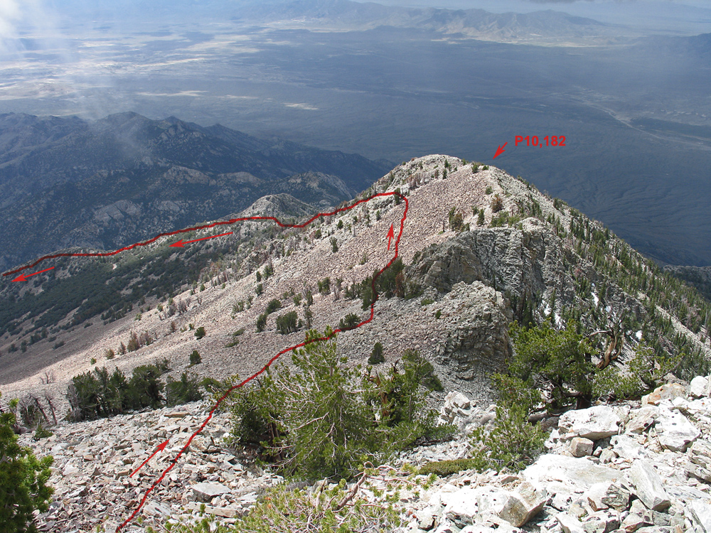
| This is close to the summit looking south at the route down. The red lines shows the approximate route. Climbing up I stayed closer to the ridge top and went directly over peak 10,182 ft. The route from the head of Miner's Canyon is 6.6 miles round-trip with 4800 feet of gain. It takes about 5 1/2 hours up and 4 hours down. Start early to avoid a build up of afternoon thunderstorms common in the late spring and summer. | ||||||||||
|
||||||||||
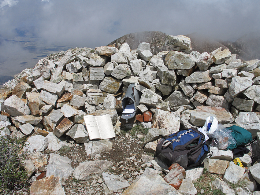
| The registers are in a mailbox in the wall of an improvised rock shelter, one of many at the summit. The benchmark datasheet is interesting reading. I didn't find any of the original copper bolts but did find several reference disks. The peak was first surveyed in 1889. | ||||||||||
|
||||||||||
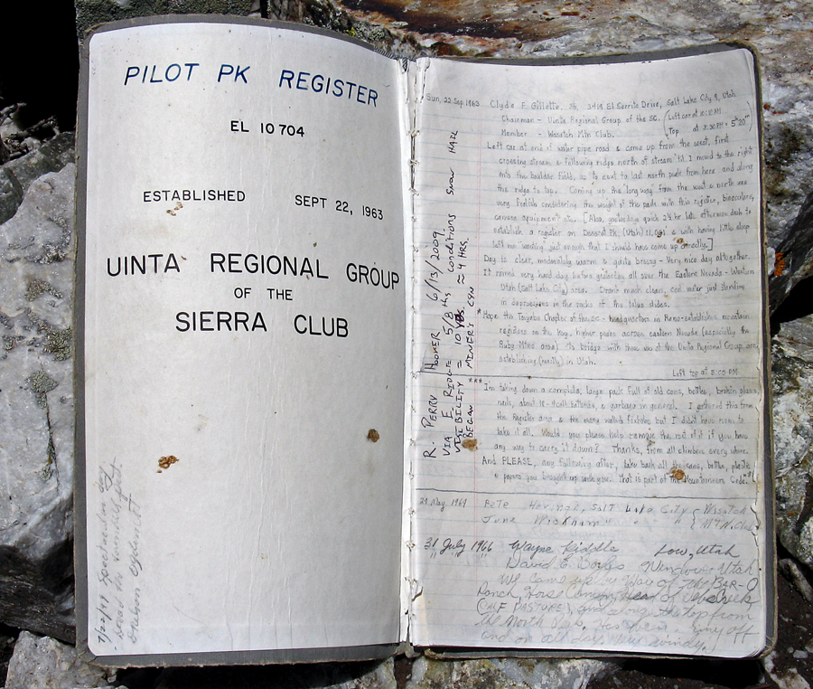
| The large register book was placed September 22, 1963. There are many entries over the years. | ||||||||||
|
||||||||||
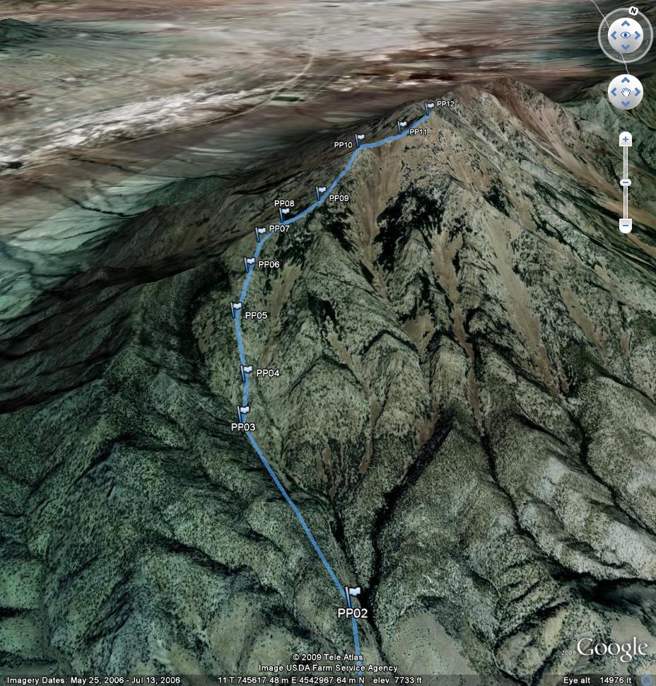
| This is a Google Earth image looking north with my waypoints shown. PP02 was our campsite at the old mine. A GPS waypoint file for this route is available. PilotPeak.gpx. A topo map page is available which shows the route I took and the BLM route. PilotPeak_map.pdf Page created July 11, 2009. | ||||||||||