Pah-Rum Peak, Washoe County, Nevada
On BLM land, Elevation = 7612 ft. (2320 meters)
Highpoint of the Fox Range
|
Pah-Rum Peak, Washoe County, Nevada
On BLM land, Elevation = 7612 ft. (2320 meters) Highpoint of the Fox Range |
||||||||||||
|
||||||||||||
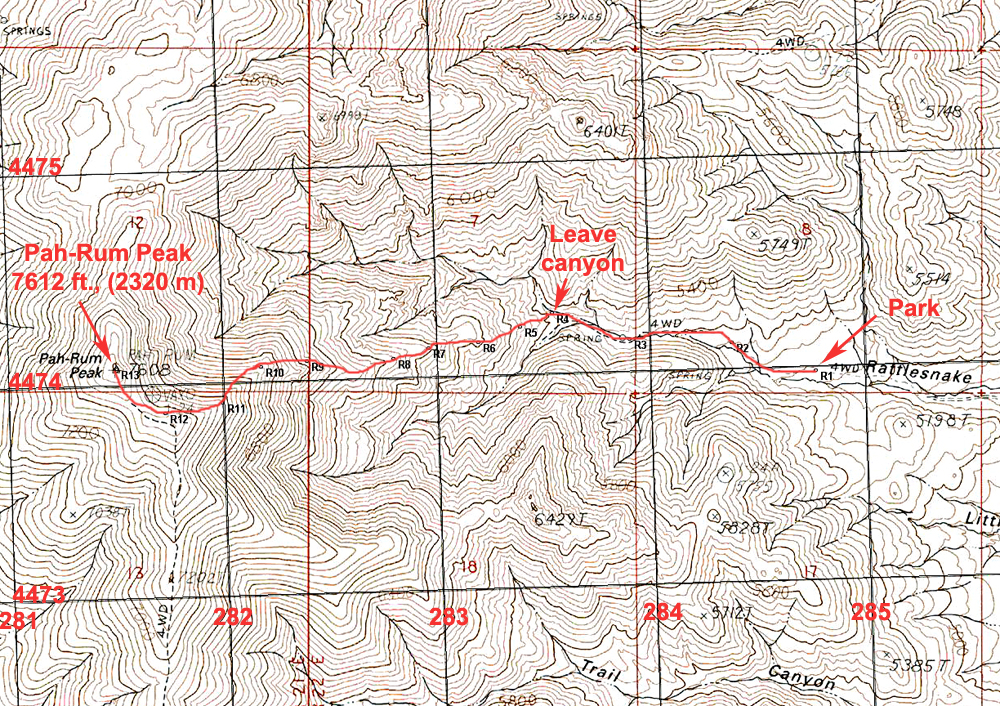
| The above map shows a good climbing route for Pah-Rum Peak. You can drive up Rattlesnake Canyon to point R1 and park by a locked gate. The road is not terrible, but is rough enough that a four-wheel drive vehicle is advised. There is a good trip report by Dennis Poulin that describes the driving route. The climb is similar to his route as well. Dennis' Report on Peakbagger. Another report by Dean Molen. The above map has the UTM grid using NAD27 in zone 11. After you pass by the trailer and hike on cattle trails in the canyon, you should leave the canyon and head up the slopes at point R4. Follow the ridge all the way. It has some rock outcrops and I passed a large one on the right side. The summit area is open with nice views. This route is 5.0 miles round-trip with a gain of about 2600 ft. It took me 2 hours and 40 minutes to reach the top. A GPS waypoint file for the above route is available: PahRum.gpx | ||||||||||||
|
||||||||||||
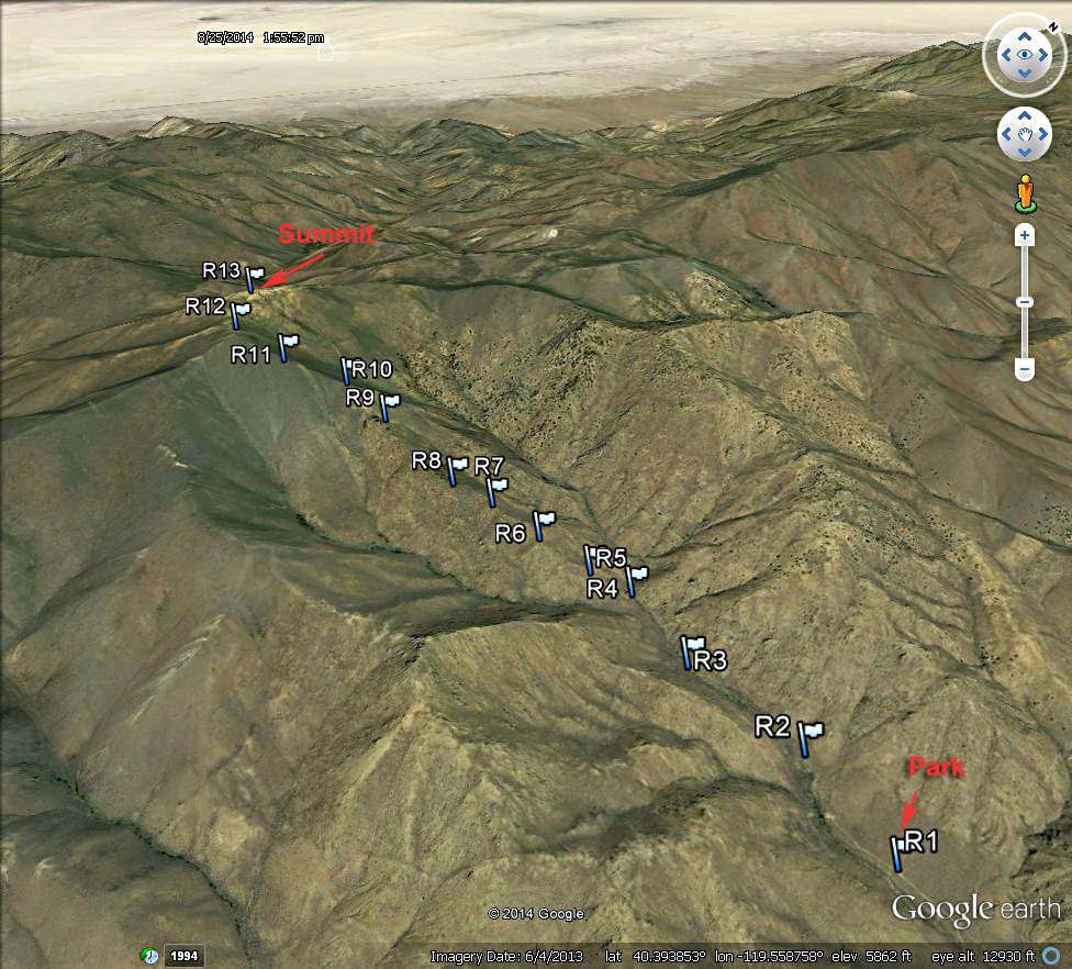
| A Google Earth view of the route up the canyon and ridge on the east side. | ||||||||||||
|
||||||||||||
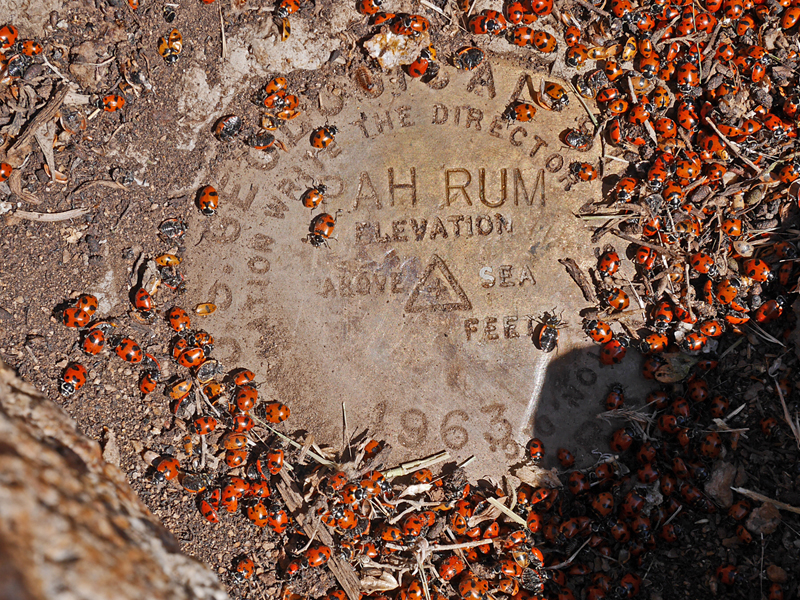
| The benchmark disk was buried in the dirt under a cairn and probably was not noticed by hikers for many years. Datasheet. | ||||||||||||