Lone Mountain, Esmeralda County, Nevada
On BLM land, Elevation = 9112 ft. (2777 meters)
|
Lone Mountain, Esmeralda County, Nevada
On BLM land, Elevation = 9112 ft. (2777 meters) |
||||||||||
|
||||||||||
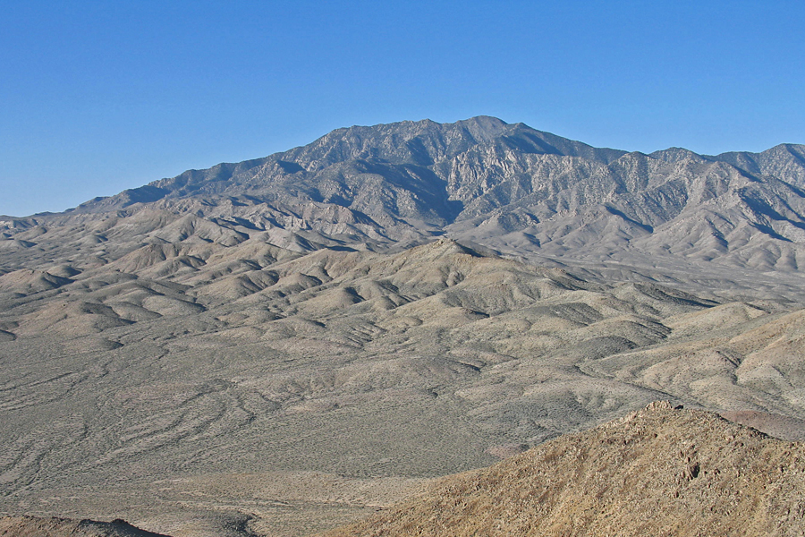
| Lone Mountain is the big prominent peak west of Tonopah. This is a view of the north side. This peak has a prominence value of 3818 feet. | ||||||||||
|
||||||||||
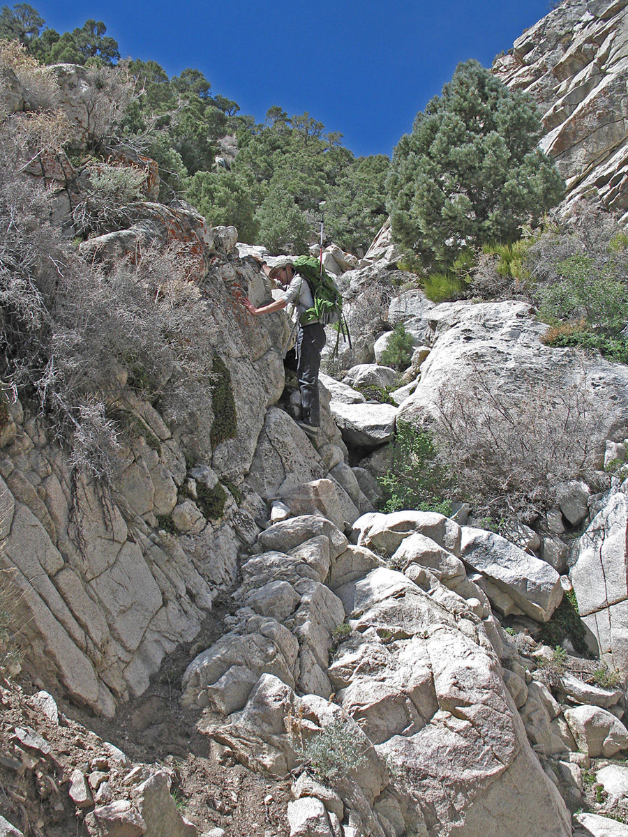
| Adam Helman coming down the boulder-filled canyon bottom in Springdale Canyon. | ||||||||||
|
||||||||||
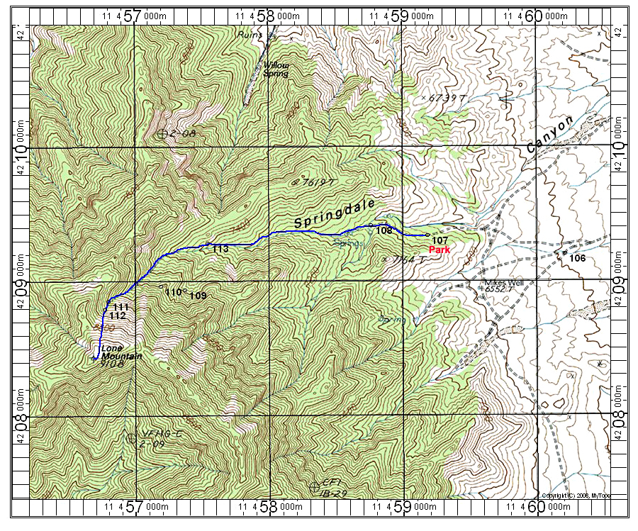
| This map shows a good climbing route on the east side going up Springdale Canyon. The UTM grid is shown using NAD27. There is a good report on the drive-in and climb at Peakbagger.com by Dennis Poulin. Following this report we got to point 107 and parked. Further on the road was bad with lots of boulders. Point 108 is the end of the road. Hike west staying in the canyon. Be careful at point 113 to stay in the correct canyon which is to the right at a divide. We went left since it looked like the bigger canyon and got to point 109 before seeing the error. It is best to stay in the main canyon although that route might have worked. The route is 4.2 miles round-trip with about 2400 feet of gain. It took us 2 hours 40 minutes up including the detour back to the main canyon. 4/13 RLC. | ||||||||||
|
||||||||||
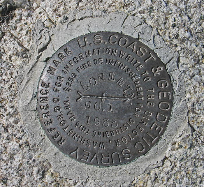
| The primary benchmark is buried or lost in a stone shelter. This is RM#1 placed in 1933. Datasheet. | ||||||||||