Gold Cross Peak, Clark County, Nevada

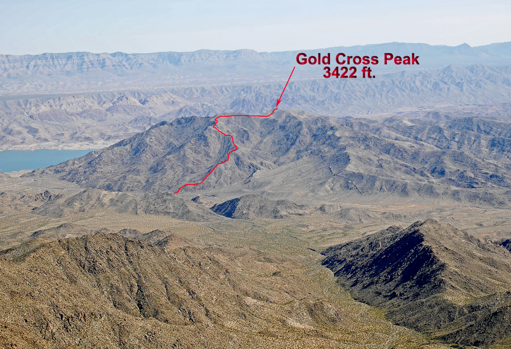
Elevation = 3422 ft. (1043 meters)

In the Lake Mead National Rectreation Area

Highpoint of the Hiller Mountains

Looking down on Gold Cross Peak from Bonelli Peak. The peak is in a remote area and requires a long, rough drive to get within range to hike the peak if coming from the north. The summit register indicates that some determined climbers have come across Lake Mead by boat and hiked from the shore on the south side of the peak. I have details here on doing the peak by road from the north.
The above map shows our hiking route once we got to the base of the mountain, point G1. The route is on a fairly easy ridge system and is 5.4 miles round-trip with a gain of about 2230 ft. The map has a one-kilometer UTM grid using NAD27. A gpx file is available: GoldCrossPk.gpx

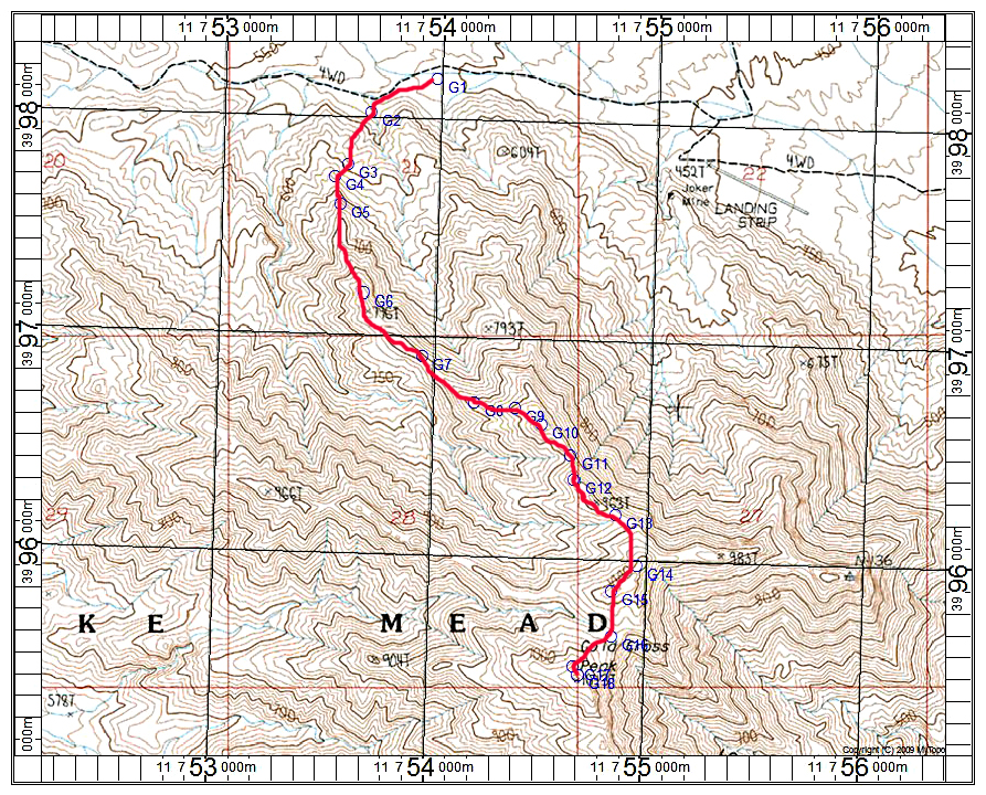
The next map shows how to get to the starting point which is a long hike from the top of the Scanlon Dugway grade.

We parked and camped at the top of the start of the steep drop down the Scanlon Dugway road. There is very limited space at this spot for camping, but we squeezed three trucks in. The road down is quite steep with a lot of loose rock for a mile or so and I do not recommend driving it unless you have an ATV or short wheelbase Jeep. Further down there are some drops over small waterfalls. We hiked the road down and over to point G1. This is 7.3 miles with a drop of 2300 ft. While doing the peak we saw a wide wash that looked like a good shortcut for the return hike. The dashed line shows this route which was 1.6 miles shorter and it worked out well. Overall you are in for a long day of 18.4 miles if you take the alternate return route and the gain is 4530 ft. counting the peak and the gain on the return. Allow about 3 hours down to point G1 and then about 5 hours up and back to the summit. Then add maybe 3 hours back to the pass.

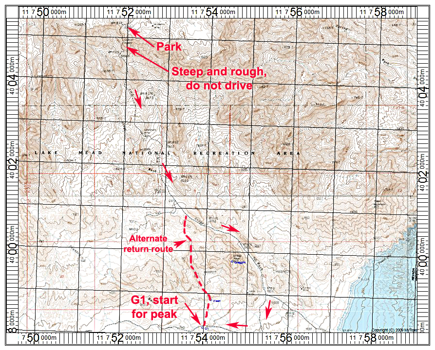
Here are driving directions to get to the pass for the Scanlon Dugway.

Leave Interstate 15 at exit 112 and go about 3 miles south to a right turn just after crossing the Virgin River onto Gold Butte Road. It is about 20 miles of rough pavement to the Whitney Pockets. From there it is another 15 miles on a good, but sometimes rough dirt road to Gold Butte. From there four-wheel, high clearance is needed. Here is a mileage log from Gold Butte south to the Scanlon Dugway:

0.0 at Gold Butte junction. Lots of space for camping in this area.

0.6 and 0.9 miles go right past spur roads

1.1 miles go left at a junction

1.6 go straight at a junction. Left road goes to Jumbo Peak.

2.1 go straight. A guzzler is on the right side.

3.9 signed junction, go left on Jeep Trail

4.2 crest of hill

5.8 another crest

6.8 corral on the left

8.9 junction, go left on route 116

9.5 junction go straight

10.1 big rocks in road

10.9 go straight. Left road goes to Nevada Mica Mine.

12.4 junction, go left on new bypass road not on topo

12.6 more big rocks in the road

13.3 junction in sandy wash, go right

13.6 go left up a hill.

14.0 pass and top of Scanlon Dugway. Limted parking here.