Dutch John Mountain, Lincoln County, Nevada
On BLM land, Elevation = 8867 ft. (2703 meters)
|
Dutch John Mountain, Lincoln County, Nevada
On BLM land, Elevation = 8867 ft. (2703 meters) |
||||||||||
|
||||||||||
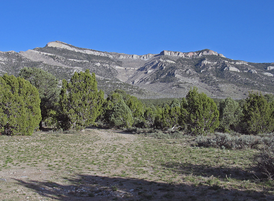
| A view of the west side of Dutch John Mountain from a good camping area on the road and where we started the climb This is point 028 on the map. If you don't mind scraping against the trees you can drive further to about point 029. The summit is the highpoint on the left side and has a prominence of 2360 feet. | ||||||||||
|
||||||||||
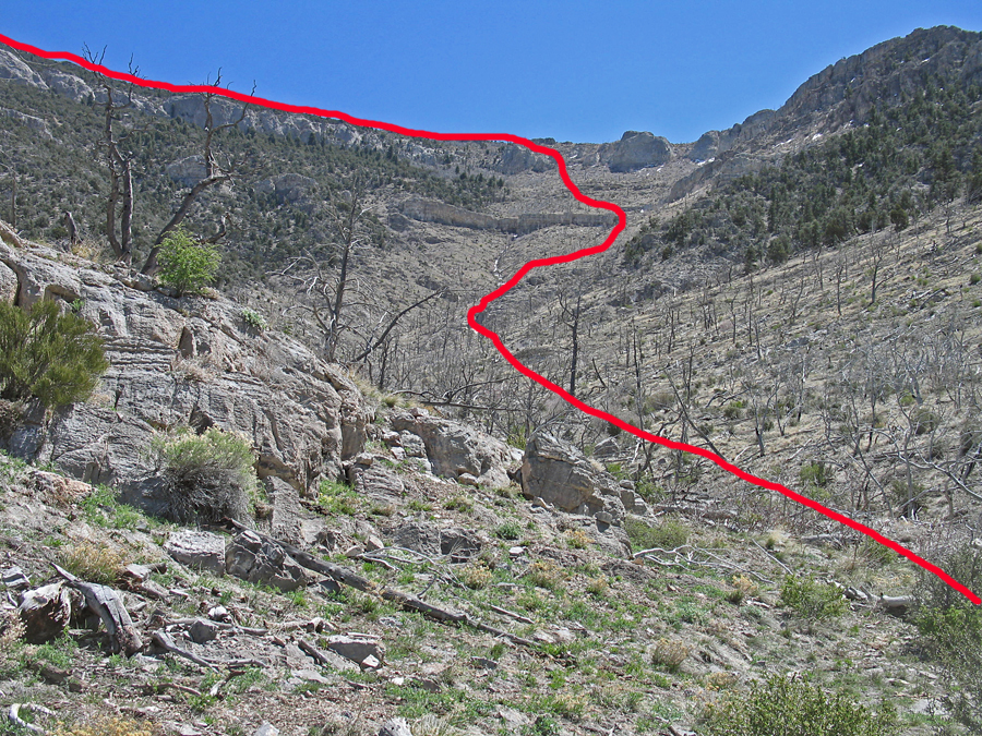
| The upper route showing the route we took through the cliff band near the crest. As can be seen here much of the west side has been burned over some time ago. | ||||||||||
|
||||||||||
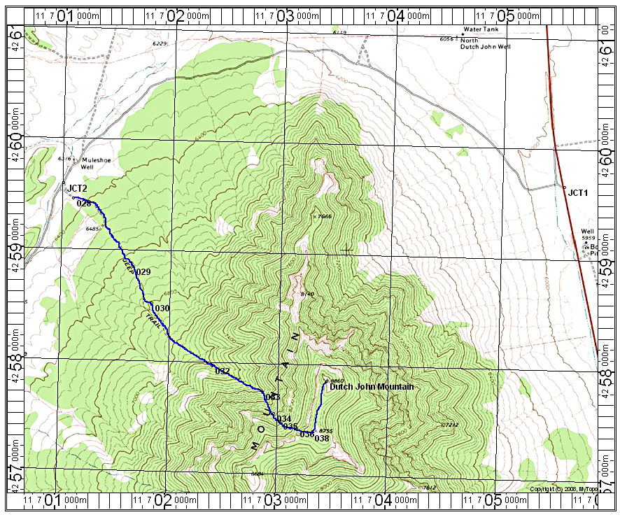
| This topo shows the drive in as well as the climbing route. The UTM grid is shown using NAD27 in Zone 11. Junction 1 is the turn off highway 93 about 10 miles north of the BLM fire station. UTM there is: 705563E, 4259660N. The dirt road is a good graded road. At 1.7 miles you will have to open a gate. Continue to Muleshoe Well at 3.3 miles and shortly after at 3.45 miles turn left onto a dirt road heading southeast. We camped at point 028 a short distance in. One can drive to about point 029. From point 028 we hiked the road toward a broad canyon. You will break out of the forest into a burned area at point 032. There are several ways up through the cliff bands to the ridge and the photo above shows our route. The hike is 5.4 miles round-trip with a gain of 2400 feet. It took us 2 3/4 hours up and about 2 1/2 hours down. 4/13 RLC A GPS waypoint file is available: DutchJohn.gpx | ||||||||||
|
||||||||||
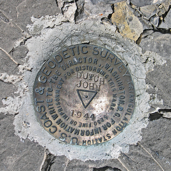
| The primary benchmark which was placed in 1944. Datasheet. | ||||||||||