|
|
|
|
|
|
|
Photos of a Climb of Mt. Meru, Tanzania, January 12-15, 2007
Mt. Meru is 14,967 ft., (4562 meters)
The prominence is 10,400 ft. (3170 meters)
|
|
 |
|
 |
|
|
 |
|
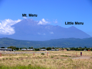
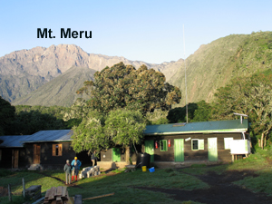
| Looking north at Mt. Meru, 14,967 ft. (4562 meters). We hike up to the Saddle Hut in the dip to the left of Little Meru. It will take two days to get there. |
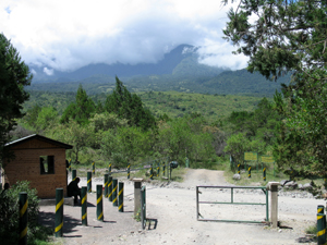
This is the Momella Gate looking west. The trail starts here. Elevation is 5240 ft. (1600 meters). |
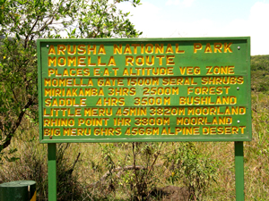
Mt. Meru is in Arusha National Park. The sign shows destinations, elevations, and hiking times. |
|
 |
|
 |
 |
|
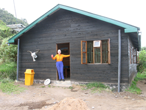
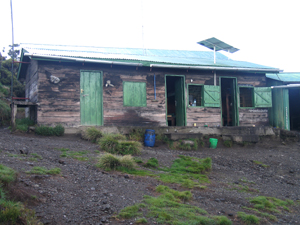
| Gail at our first hut at Miriakamba. This bunk house has six rooms with four beds in each. Pads provided. This is at 8250 ft. (2515 meters) and it took us 3.5 hours to get there. Dining is in large hut close by. |
Bunk houses for porters. View in the morning looking west with Meru summit in the back. |
|
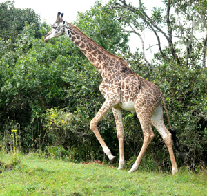
| Wow! We see four giraffe higher up in the forest. They are not always down in the plains. |
|
 |
|
|
 |
 |
|
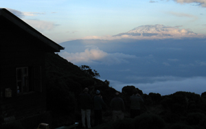
| A nice view looking east of Kilimanjaro at sundown. We get going the next morning at 4:00 AM after waiting several hours for heavy rains to stop. |
|
| This is the porters and guide bunk house at the Saddle Huts. Elevation 11,700 ft. (3566 meters). It took us four hours from Miriakamba to get here. The trails are good. |
|
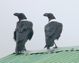
| White-naped ravens on the hut roof. |
|
 |
 |
 |
|
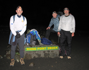
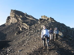
| Heading to the summit. This is a minor bump on the ridge called Rhino Point at 12,467 ft. (3800 meters). The Strauch brothers from left: Tim, Tom and John. |
Tim Strauch on the ridge... getting close now! The sun has come up and there are views of Kilimanjaro. |
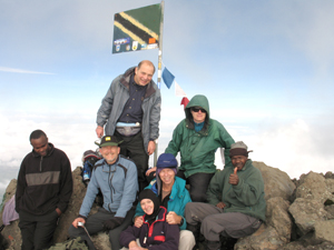
We made it! It took 4.5 hours from the Saddle Hut. The weather is OK, but the clouds soon obscure the view. |
|
 |
 |
 |
|
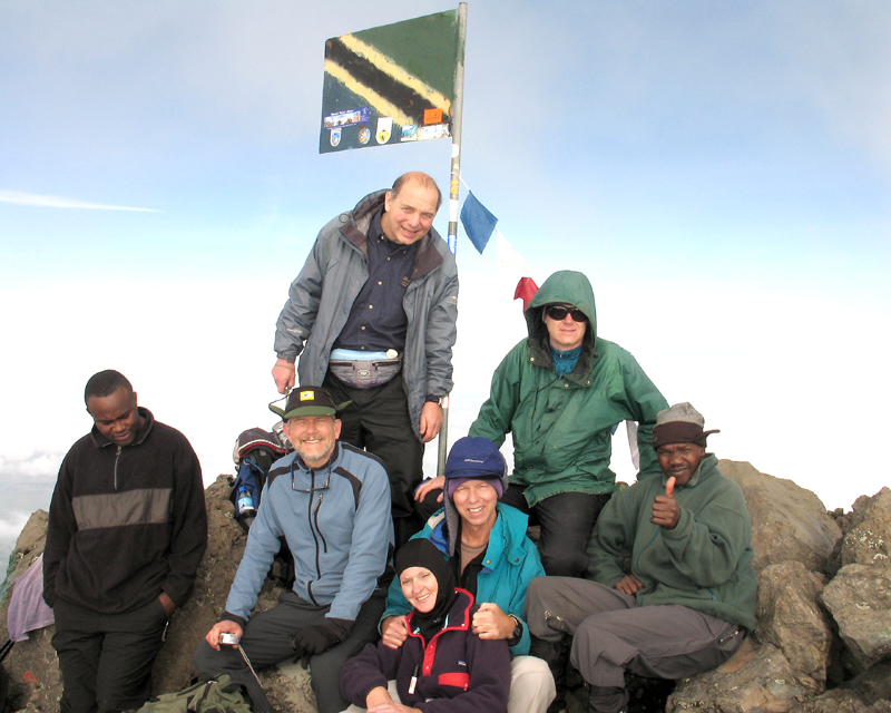
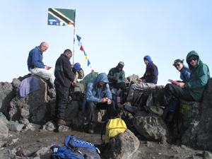
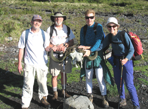
| Gathering around the Tanzania flag. There is a register in a metal box. A handful of people climb it every day. From left: Ranger Naseri, Tim, Tom (standing), Shelley, Richard, Edward, and Guide Matei. January 14, 2007. Click on this photo to expand it. |
|
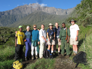
Our group on the last day starting our hike down on the road that comes up to Miriakamba Hut. We had hiked from the summit down to the first huts. Our group from left: Porter, Gail, Edward, Tim, Shelley, Tom, Ranger Naseri, and John. It took 4 hours to hike down the road which goes through a thick forest. |
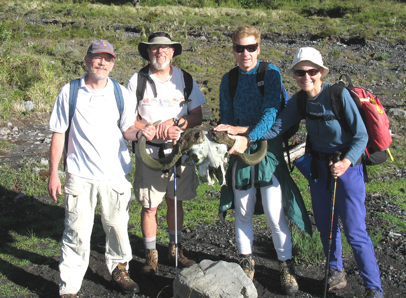
Tim, John, Edward and Gail holding up a big skelton with horns from a Cape Buffalo. Click on to expand. |
|
|
 |
|
|
 |
|
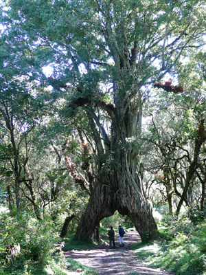
| The famous large fig tree with the road cut through it. |
|
|
|
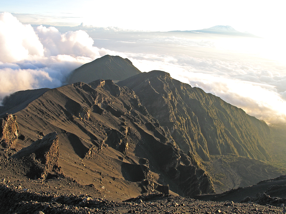
A impressive view looking down from near the summit with Kilimanjaro in the distance. |
|
|
|
We used Shah Tours & Travel based in Moshi who set up the trip for us. I highly recommended them.
http://www.kilimanjaro-shah.com |
|
Mt. Meru GPS file: MtMeru.gpx
Explanations of the waypoints in the GPS file:
These waypoints were taken on a climb of Mt.Meru, January 12-25, 2007.
MER01 is at the southern entrance gate. MER02 is the Momella gate and guard post where the hike starts. After walking across fields with buffalo there is a stream crossing at MER03.
MER04 is on the trail. MER05 is the Miriakamba Hut at 8250ft. elevation, reached after 3 1/2 hours hiking.
MER06 is on the trail above the hut at 9100ft. MER07 is at a stone bench with nice views at 10,200ft.
MER08 is on the trail. MER09 is at the Saddle Hut at 11,720ft.
It took 4 hours from the Miriakamba Hut to the Saddle Hut. MER10 is at Rhino Point, a minor peak at 12,762ft.
MER11 and MER12 are on the barren, rocky ridge. MER13 is at the summit with sign and flagpole at 14,967ft.
The hike from the Saddle Hut to the summit took about 4 1/2 hours. 3/07 RLC
|
|
|
|
|
|
|
|
|
|
|
|
|
|
|
|
|
|