Pico Zunil, Guatemala
The elevation is 3542 meters (11,621 ft.)
|
Pico Zunil, Guatemala
The elevation is 3542 meters (11,621 ft.) |
|||||||||||
|
|||||||||||
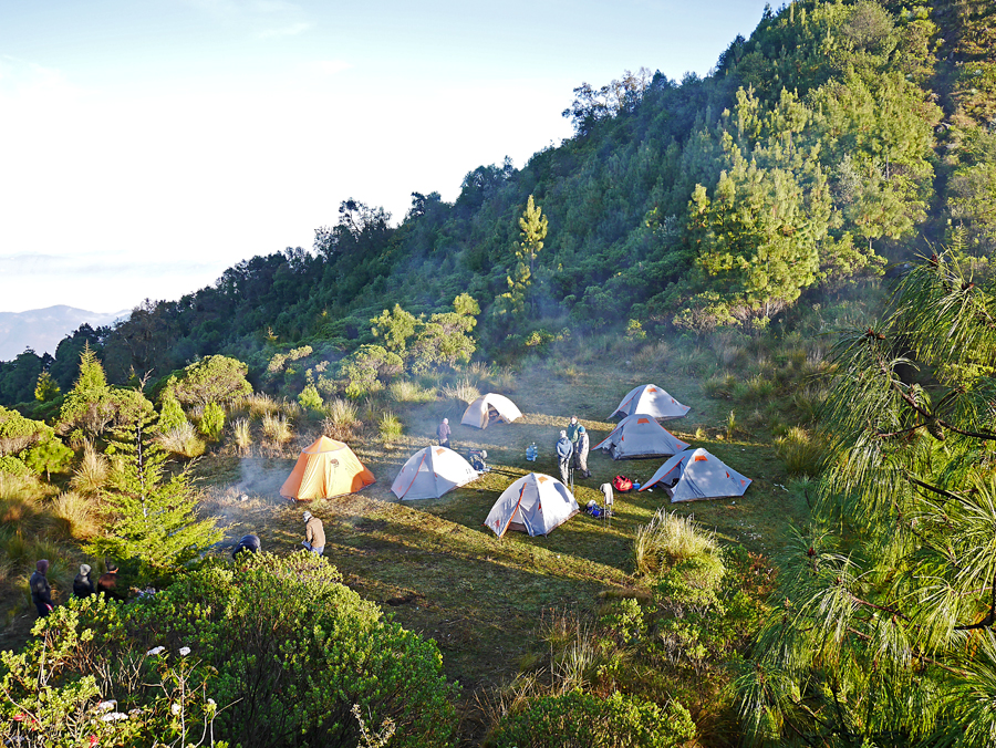
| Our campsite on the ridge on Pico Zunil at 10,820 ft. | |||||||||||
|
|||||||||||
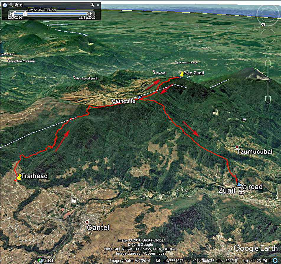
| A Google Earth image showing the hiking route we used on Pico Zunil. The route up to the campsite was about 5.4 miles with a gain of 2600 ft. We went to the summit the same day and then camped. The next day we went down an alternate route to a paved road at 7100 ft. in the town of Zunil. This descent was about 3.6 miles. A GPX track file for this route is available. Pico Zunil.gpx | |||||||||||