In the Sierra Nevada, Prominence = 1683 ft.
In the Toiyabe National Forest, Hoover Wilderness.
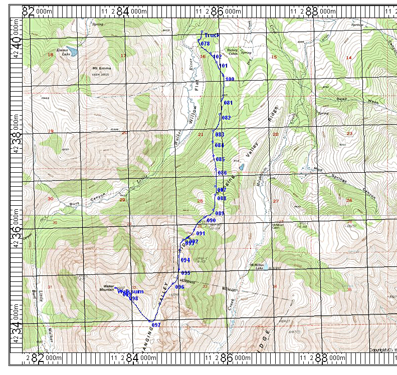
Driving Directions: To reach the trailhead drive highway 395 south of the junction for Sonora Pass for 0.8 mile and turn right (south) on forest road 066 towards Obsidian Campground. After about 3.6 miles pass the campground and make a bend to the right then back left. Take a spur on your left which is a rough road where high clearance is advised. Follow this to its end at a locked gate at 4.8 miles. There is only room for two vehicles to park here. I camped back about a tenth of a mile at a wide spot which had room for only one vehicle. This is shown at point TRUCK on the map.
Hiking Route: Walk by the locked gate (078) and then in a short distance go left on a use trail over a hill. Leave the trail and go south through the valley and pick up a cow path. Follow it to point 083 where you will start ascending through the forest. Go due south up to near a bump at 10,259 ft. and turn more to the west. Then climb through low pines to a point just to the east side of the first small rocky peak at 11,280 ft. Go to a saddle between the two peaks at point 096. Stay to the right (west side) of peak 11,379 ft. and descend on a faint use trail to a broad drainage. It is an easy walk west up to the summit which is the first bump at the east end of the ridge top. The route is 11.2 miles round-trip with a gain of about 3800 feet. Allow from 3 1/2 to 4 3/4 hours for the ascent and 3 hours to go down.