In the Klamath National Forest,
Highpoint of the Siskiyou Mountains in California
California, Preston Peak, 7313 ft., prominence is 2549 ft.
Trip report on a climb of August 21-23, 2005, by Richard L. Carey.
Preston is in the Siskiyou Wilderness in far northwestern California. It is the highest peak for many miles and is visible from many summits in Oregon including Mt. McLoughlin. If you have done Bear Mountain, the highpoint of Del Norte County, you have probably looked over at Preston, which is only 4 miles away and 900 feet higher.
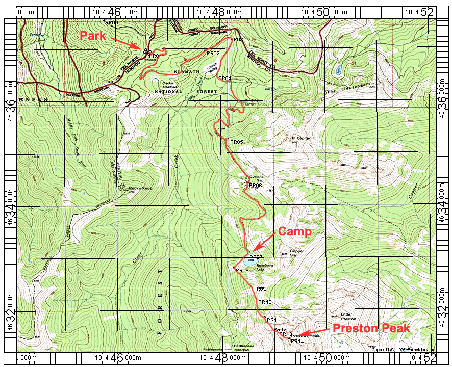
Getting to the peak: From the Oregon border drive south on route 199 for 6.5 miles to Knopki Creek Road, Forest Road 18N07. Drive east on this fairly good, graded dirt road. Pass by junctions with 18N11 at 6.0 miles and 18N02 at 13.5 miles and reach the new trailhead at 14.2 miles. We camped here and there is room for a few vehicles. No water or toilets. No permits are needed for this wilderness area, which doesn't get many visitors.
Hike details: Hike on the road ¾ mile to the old Young's Valley trailhead and then follow the road, soon a trail, as it descends 600 ft. to the valley floor. The trail turns south and there is a sign and Geocache at a trail junction. Go left here and pass by old mine ruins and climb over a ridge and then descend to Raspberry Lake. There is a fine camping area in the trees close to the lake. The hike is 7.1 miles and took us 4 ½ hours with packs. We stayed two nights here and drank lake water unfiltered with no ill effects. There were a few mosquitoes, but never very bothersome.
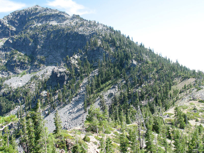
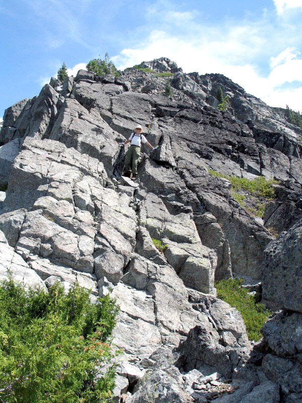
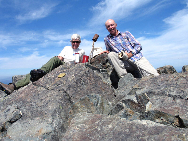
Peak climb: Head west from the lake through the brush and pick up use trails to the ridge top. Head south along the ridge and pass by minor peak 6121 to a broad saddle. The ridge towers above and looks difficult, but we found a use trail and cairns and stayed close to the ridge sometimes moving slightly right or left. There are some sloping slabs to cross and scrambling over talus, but the route is never more than class 2 with no great exposure. It is a steep climb of 2300 ft. and 1.5 miles to the top, which we reached in just over four hours. We enjoyed fine views and left a register. We followed the same route down and were back in camp in 3 ½ hours. Our pace was slow and I would say many could do this route in 3 ½ hours up and 2 ½ to 3 hours down. If you're in a hurry there might be time to pack out.
Maps: The Klamath NF map is handy, but it doesn't show all of the drive into the trailhead which is better shown on the Six Rivers NF map. The entire route cuts across four topo maps, but the 1:24K Preston Peak map shows Raspberry Lake and the summit.
Notes: We met two fellows who had done the summit from Rattlesnake Meadows to the west and descended to Raspberry Lake, and later on our way out we encountered a couple who had done it years ago up and down from Rattlesnake Meadows so that is an option. Water may be more of a problem at this meadow however.
If you are driving in from Happy Camp on highway 48 you can take Forest Road 4803 south. It is not marked at the highway other than a sign "Waldo Lookout". This is a good dirt road and will take you to the same trailhead.
A GPS waypoint file is available for the route shown on the map below. PrestonPk.gpx