Peak 2973 ft. (906 m), Riverside County, California
In the southern Coxcomb Mountains, Prominence = 1113 ft.
|
Peak 2973 ft. (906 m), Riverside County, California
In the southern Coxcomb Mountains, Prominence = 1113 ft. |
|||||||
|
|||||||
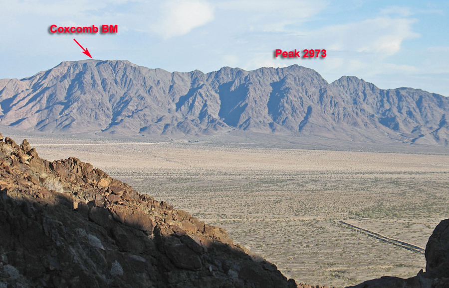
| Looking west at the southern part of the Coxcomb Mountains in Joshua Tree National Park. Peak 2973 feet is the highest peak in this area of the range. Coxcomb Benchmark is lower at 2957 feet. The peak was climbed by ascending the canyon with the smaller dark shadow just to the left of the summit. | |||||||
|
|||||||
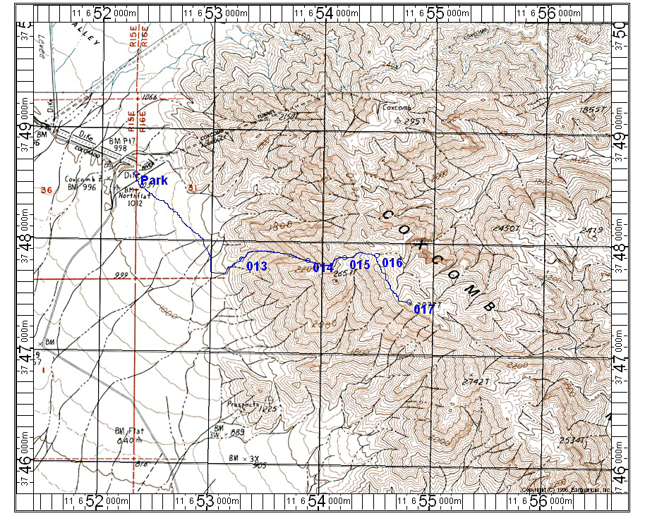
| This topo map shows a climbing route for Peak 2973 feet in the southern part of the Coxcomb Mountains. The peak is in the wilderness of Joshua Tree National Park. To reach the trailhead take route 177 north from the exit at Desert Center on I-10. Drive north for 10.4 miles and turn left (west) onto a good graded dirt road. Follow this for about 8 miles until you approach the aqueduct area. On the right are graded mounds of dirt in an old mining area. Park here. From there hike southeast into a canyon that will take you up to the crest. This is the second canyon that you see and is past and further south of another major canyon. At the crest go south along the crest to the summit. The terrain is easy along the crest with a little scrambling through rock at the summit. The route is 5 miles round-trip with a gain of 2000 feet. This is a good peak in a remote and seldom visited area. The UTM grid using NAD27 datum is shown on the above map. | |||||||