Mount Hoffman, Siskiyou County, California
In the Modoc National Forest
Elevation = 7921 ft. with a prominence of 2373 ft.
|
Mount Hoffman, Siskiyou County, California
In the Modoc National Forest Elevation = 7921 ft. with a prominence of 2373 ft. |
||||||||||
|
||||||||||
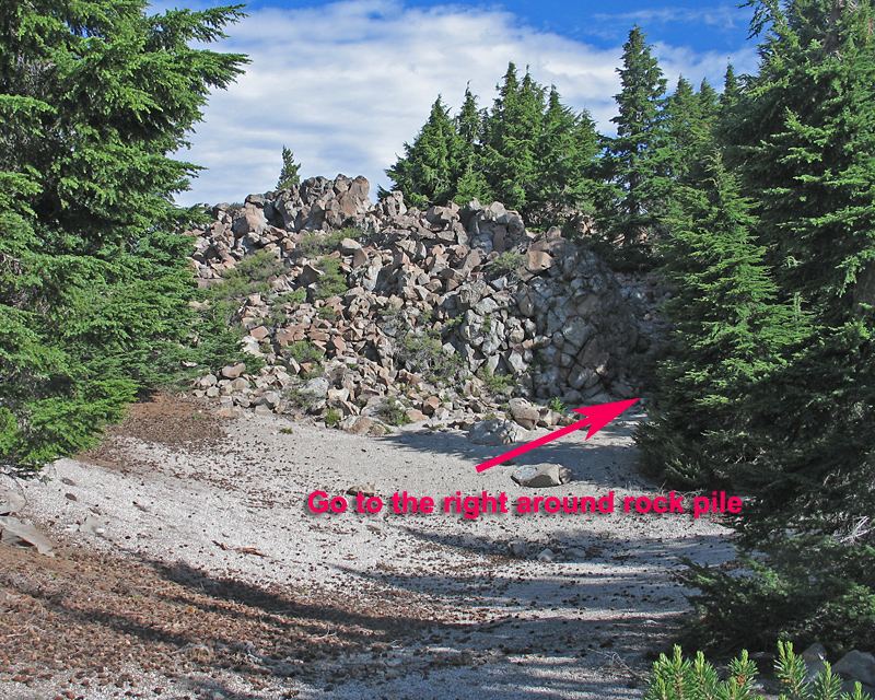
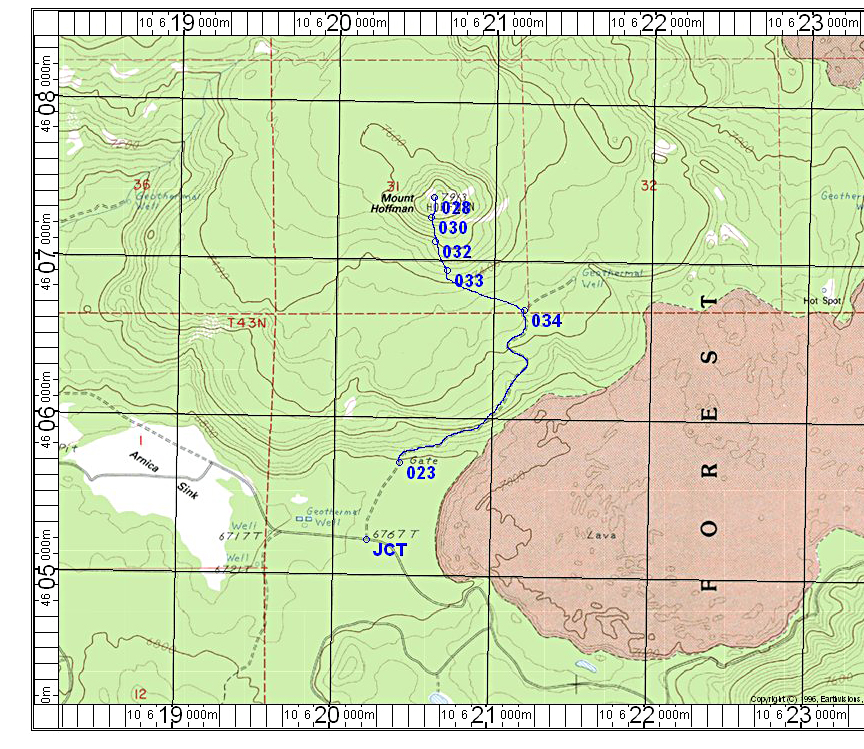
| The summit area of Mount Hoffman. The hike, shown on the map below is a pleasant 1.9 miles one-way with a gain of about 1100 feet from the gate. Leave the road at point 034 at a bend to the right. Go through the forest which is good with no brush. The small white band below the summit is a talus slope which is best to avoid. Go far enough to the left (west) to go around most of the rock. Work your way to the top through some rock and brush. There is a register can in the center of the rock pile. | ||||||||||
|
||||||||||
| To reach the mountain from the south take highway 89 east from Mt. Shasta City and turn north onto route 15, Harris Springs Road. Then after a few miles take route 49, Powder Hill Road, up to Medicine Lake. Go past the Medicine Lake turnoff for about 1.6 miles and turn right onto 43N99. Follow this graded dirt road through the Arnica Sink for 2.0 miles and turn left onto 3N99B. The gate at point 023 was open, but further up there is a larger boulder blocking the road. It appears a small vehicle could get by this and continue to point 034, but it is hardly worth it so I suggest parking by the gate. The UTM grid is using NAD27 in zone 10. | ||||||||||
|
||||||||||
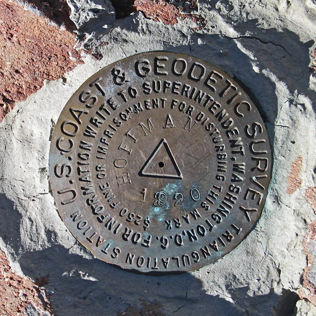
| The benchmark, placed in 1920 is in good shape. | ||||||||||