Located in the Kingston BLM Wilderness Area
Highpoint of the Kingston Range, Prominence value is 3753 ft.
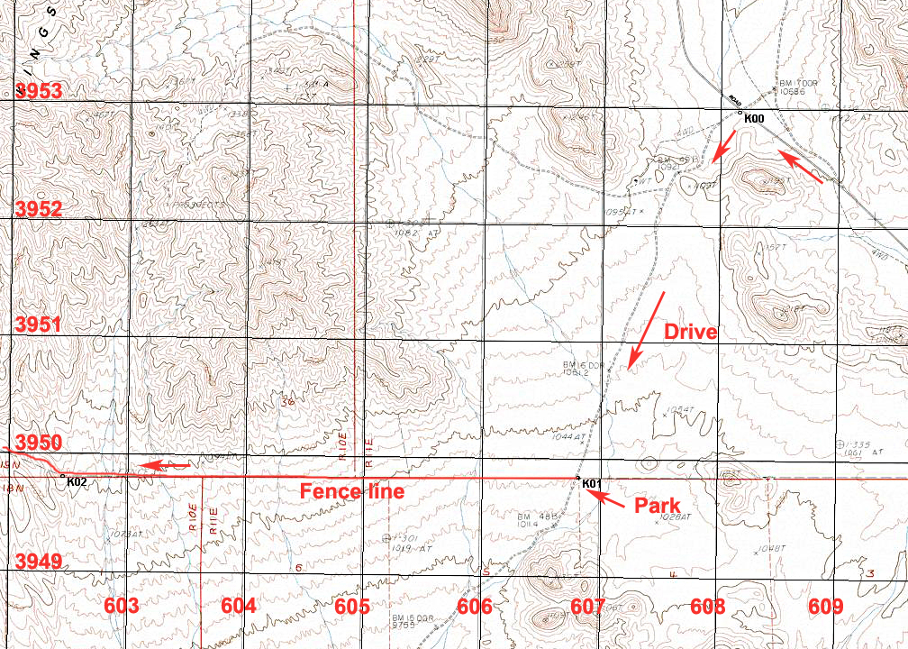
Driving Directions: Driving northeast from Barstow on Interstate 15, take the Cima Road exit. Going north the road is paved for about 20 miles. Note these mileages on this road to the trailhead: At 13.4 miles stay left on the Excelsior Mine Road where the pavement is rougher. At 21.1 miles (K00) reach a junction with a dirt road on your left. There is a BLM kiosk here. Turn left and follow this fair dirt road for 2.3 miles to a gate at an east-west fence line (K01). A high-clearance vehicle is best for this dirt road. There is camping space by the gate for a couple of vehicles.
Climbing Directions: Start the hike heading west along the fence on a fading access road. It is 3.3 miles to a mine area and the start of the ridge at K03. The ridge is fairly easy in the lower area. Go over the point at 1555 meters shown on the map and descend about 40 meters to a saddle and then continue up to point 1781 meters. It is easiest to contour to the right around this point rather than go over it then turn to the west and a short descent then up the ridge line. At K09 is a small saddle and the start of a steep climb. You can contour right near the top of this section over to K10, a level section on the ridge. Up ahead there are large blocks where we stayed right to get around a set of boulders then went to the left (west) side for the final part up to the summit. This route is 14 miles round-trip with a gain of about 4600 feet. Be sure to get an early start and take plenty of water and plan on a return partly in the dark. Our hike took 6 1/2 hours to the summit and 7 hours on the return since we were slowed down by darkness. In the spring this mountain is noted for an abundance of ticks. 1/06 RLC The maps below show the route. The UTM grid is shown using NAD27, Zone 11. A GPS waypoint file for this route is available: KingstonPk.gpx
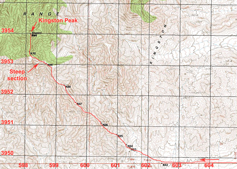
There is no benchmark disk at the summit. The surveyors sighted on a large cairn. Datasheet