Siskiyou County, California
Located in the Shasta-Trinity National Forest
Highpoint of the Whitehorse Mountains
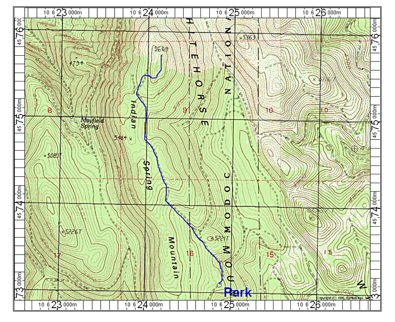
Take route 299 northeast from Redding through Burney. Just before Fall River Mills turn left (north) onto Dana Road to Glenburn. Take A19 north and after a couple of bends take 40N04 north. This turns into a good graded dirt road. Follow this for about 14 miles. About a half mile past milepost 14 turn right onto 40N33Y (signed). Set your odometer and note the following points: At 1.9 make a switchback to the right.. At 2.7 there is another switchback to the right. At 4.8 miles go left at a junction. At 4.9 stay to the left. At 5.4 go right on a poor road. I parked at a slight wide spot at 5.9 miles as the track seemed to narrow and go downhill. From there hike downhill a short distance then left. Follow the old road and go left at a junction in about half a mile. This road goes up and ends at a point southwest of the summit which is spot elevation 5669 feet. At a metal stake go right up to the ridge on paths through the brush. Turn north along the east side of the ridge. The summit is a rock pile and the last 100 feet is heavy brush. There isn't any way to avoid this so you will have to push through it to reach the top. The hike is 4.4 miles round-trip with a gain of about 800 feet. 7/12 RLC