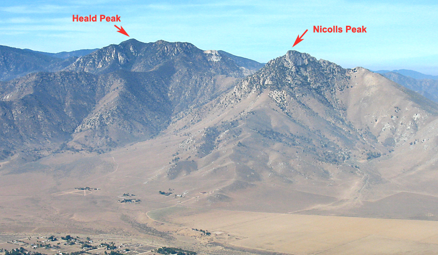
Located in Sequoia National Forest and the Piute Mountains
Driving Directions: Here is how to reach the trailhead. From highway 178 west of Weldon go 0.2 miles west of the road to the Kernville Airport and turn left (south) onto Vista Grande Road. The road is signed and there is a Post Office on the west side. Reset your odometer and note the following junctions:
0.0 at route 178
0.7 Go right onto Hillview Acres Road at a T intersection
1.5 Turn left onto Brooks Road
2.8 At the end of the wide road go left onto a poor dirt road which has a BLM designated route sign.
This is close to a brown home on your right. High-clearance is needed from here on.
There are several parallel paths through the pinyons. Pick the best one and look for the sign at 3.1 miles.
3.1 Go left onto Last Chance Road which has a beat-up sign.
3.2 Stay left heading east at a junction. (Thanks to Mark Lyons for the correction here, left NOT right.)
3.8 Climb a hill with some big rocks in the path. Continue up the canyon.
4.5 A useable campsite is on the left. Continue another 0.2 miles through a fence line to the road's
end at the trailhead. Waypoint H2. There is limited space for about three vehicles here, but it is
not flat for camping.
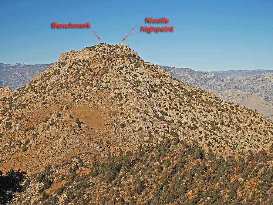
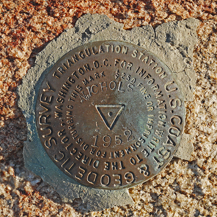
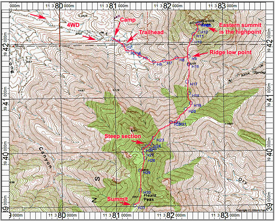
Climbing Notes: From the trailhead go a short distance on a use trail and go left on a lesser trail across the wash. Head over to the main canyon (point H4) and stay in the canyon bottom heading east. At H6 start up the steep slopes following cairns where you see them. Head for the low point in the ridge. From here one can do Nicolls Peak as shown. At point H10 on a small ridge, drop down to your left and go across to a better slope heading up. Close to the top the benchmark is to the left, but the true highest summit is the rock pile to the right which has an HPS ammo box register.
From the low point on the ridge head south for Heald, staying mostly on the ridge. The route has a well-worn use trail that is easy to follow. At point H24 you will start a steep climb in the trees. Watch for cairns in here to avoid class 3 problems. At the top the route heads south. The trail has been mostly cleared through the brush. The register is further south from point 6901. The summit has been burned over and is not very attractive. The route is about 1 mile from the trailhead to the ridge at point H9 with a gain of 1100 ft. From there is is about 1/2 mile with a gain of 950 ft. to Nicolls Peak.
Heald Peak is about 2.3 miles one-way from the saddle with a gain of about 2200 ft. counting a few drops on the ridge.
If you climb both peaks the total distance is about 7.6 miles with a gain of about 4250 ft. It took me about one hour and 15 minutes to reach the saddle and another 50 minutes to climb Nicolls. After Nicolls it took about 2 3/4 hours to reach Heald summit. Overall both peaks took 8 hours and 40 minutes.