Located in Death Valley National Park
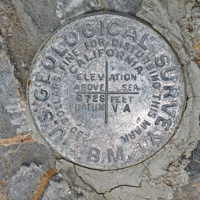
Highpoint of the Last Chance Range, Prominence value is 3614 ft.
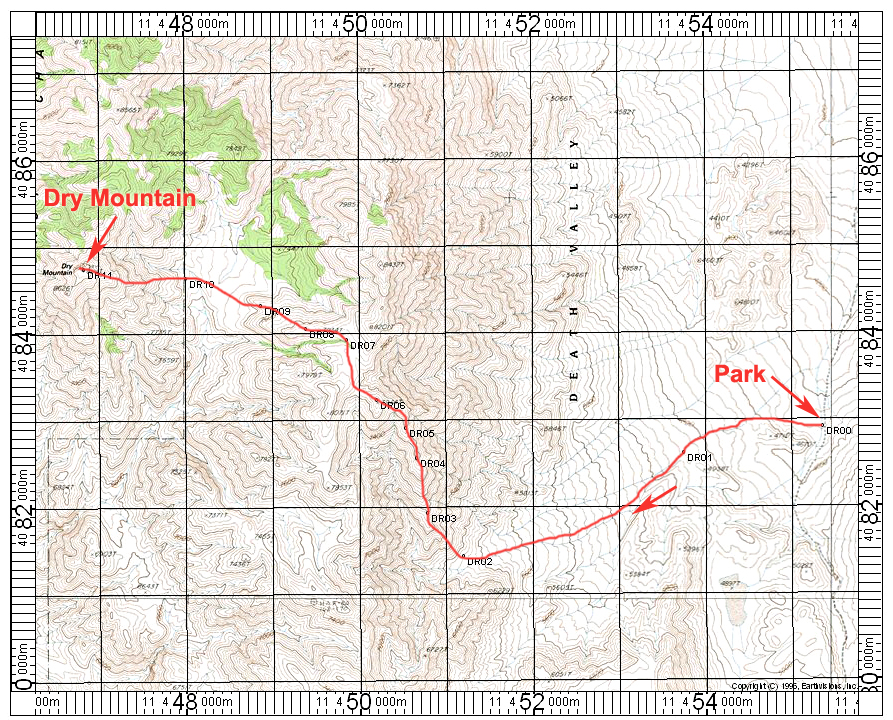
Driving Directions: Get an early start and drive west toward Ubehebe Crater. Near the Crater a dirt road starts south to The Racetrack. From the pavement follow this rough road south for 9.3 miles to a small wide spot where you can park on the right side. A high-clearance vehicle with good tires is needed for this road and four-wheel drive is normally not needed. The parking spot is waypoint DR00.
Hiking Route: Hike west around some low hills and enter a wide wash. Follow this southwest to thebase of a ridge at DR02. Hike northwest ascending this long ridge up to P7944 ft.(DR06) shown on the map. Traverse north across minor canyons to an east-west ridge and follow this ridge west past P7934. Descend this ridge and cross a valley to the base of the final hill. (DR10). It is about 1400 feet of gain up to the summit. This route is 14.2 miles round-trip with about 6000 feet of gain. This includes about 1000 feet of gain on the return. Allow 11 to 12 hours for the hike. You should start hiking by 7:00AM. Allow one hour of driving time from Mesquite Springs Campground to the starting point on the road. Take plenty of food, water and a flashlight. 4/06 RLC A GPS waypoint file is available for this route: DryMtn.gpx