Bat Mountain, north summit, 4958 feet, Inyo County, California

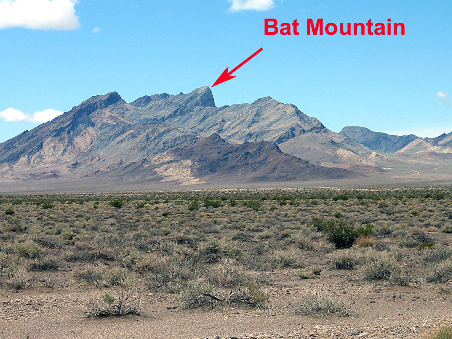
Located on BLM land in the Funeral Mountains Wilderness

Bat Mountain has two summits of nearly equal height as shown on the East of Ryan 1:24,000 scale topo map. The summits are about 0.7 mile apart and the southern one has a spot elevation of 3950 feet. The northern summit does not have a spot elevation shown. Photos taken March 31, 2013 on a climb of the north summit. I had previously climbed the south summit and determined the north was higher using a very simple level. We went back with a better instrument.
A view looking south from about point 018 on the map. We stayed to the left to avoid some cliffs and reached a saddle east of the peak at point 022. The saddle is the low point on the ridge in this photo.
Sighting on the south summit after setting the bubble level showed it to be about 5 to 8 feet lower. I am using a 32X automatic level.

Notes: The accuracy of the level is specifed as +/- 1/16 inch at 100 feet. At 1000 feet or ten times this distance the error might be +/- 5/8 inch.

This is our route up which took about 3 hours. On the way down we went through a canyon which is shown on the next map. This would work going in and avoids the mine area.
Driving Directions: On highway 127 (373 in Nevada) turn off west at a point 0.6 miles south of the CA/NV state line. The dirt road here is marked as Clay Road. Drive southwest on the good road for about 0.9 miles and turn right. Follow the road north then west around a hill to a locked gate at a mining area after 5.2 miles. Park here. This road is suitable for most any vehicle.

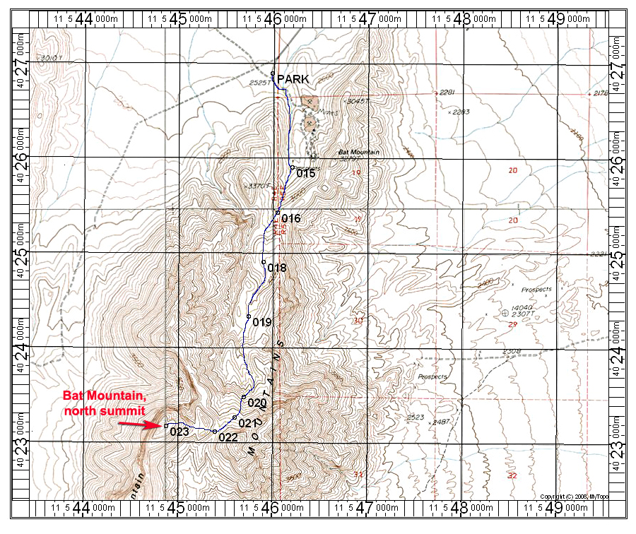
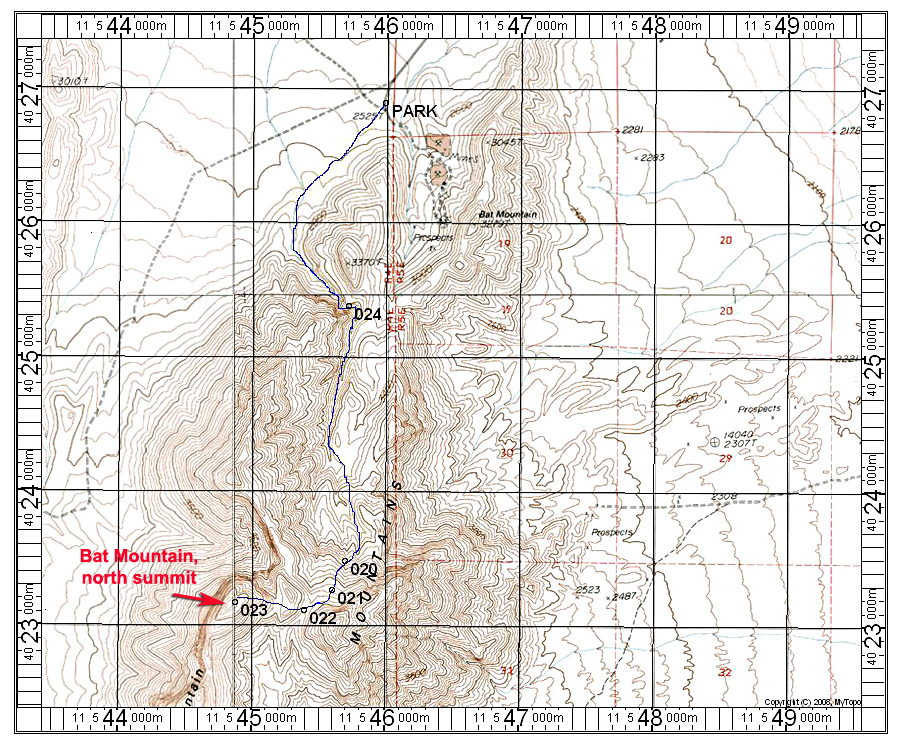
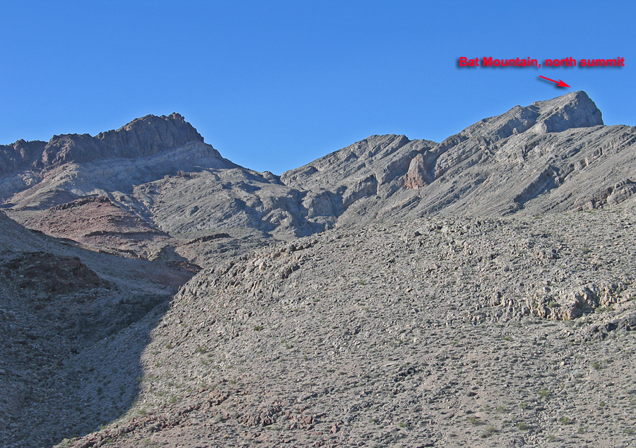
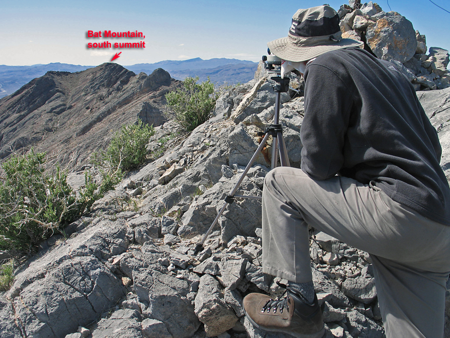
Climbing Directions: You can go into the mining area and turn right up a canyon following the first map, or if you want to avoid the mine go south into the canyon shown on the second map. You eventually come out onto a broad area of drainages. Climb up to a saddle staying to the east side of a cliffy area. At the saddle go over a small rise to a second saddle then up the steep limestone slabs to the summit. Footing is good on this rough-surfaced rock. The route is about 6.6 miles round-trip with a gain of 2500 feet. Allow about 3 hours each way. 3/13 RLC