|
|
|
|
|
Arica Mountains, 646 meters, Riverside County, California
Summit ridge is on the boundary of the Palen-McCoy Wilderness
|
|
 |
|
|
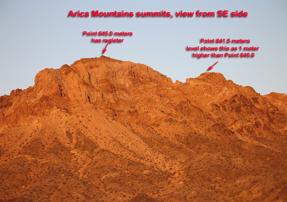
The Arica Mountains are a small north-south trending range in the eastern part of Riverside County about 30 miles west of Vidal Junction and south of highway 62. The above photo is an early morning view of the east side of the range. The two highest peaks are shown with their summit elevations in meters from the Arica Mountains 1:24,000 scale topo map. Peak 645 meters looks higher in this view, but a previous trip showed that the northern pinnnacle could be higher when sighted with a primitive level. Another climber, John Vitz, had said that he thought the north peak was about 3 feet higher. On November 24, 2012 we climbed Peak 645 meters and sighted with a 32X automatic level, a very accurate device. |
|
|
 |
|
|
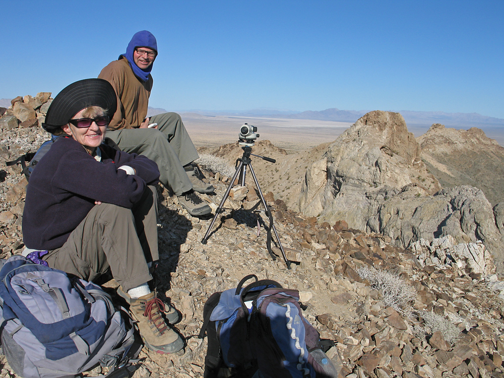
Shelley Rogers and Mark Adrian at Peak 645 looking north to the knob which looks like a difficult or hazardous climb. The northern peak is about 320 meters away (1050 feet) measuring on the topo. |
|
|
 |
|
|
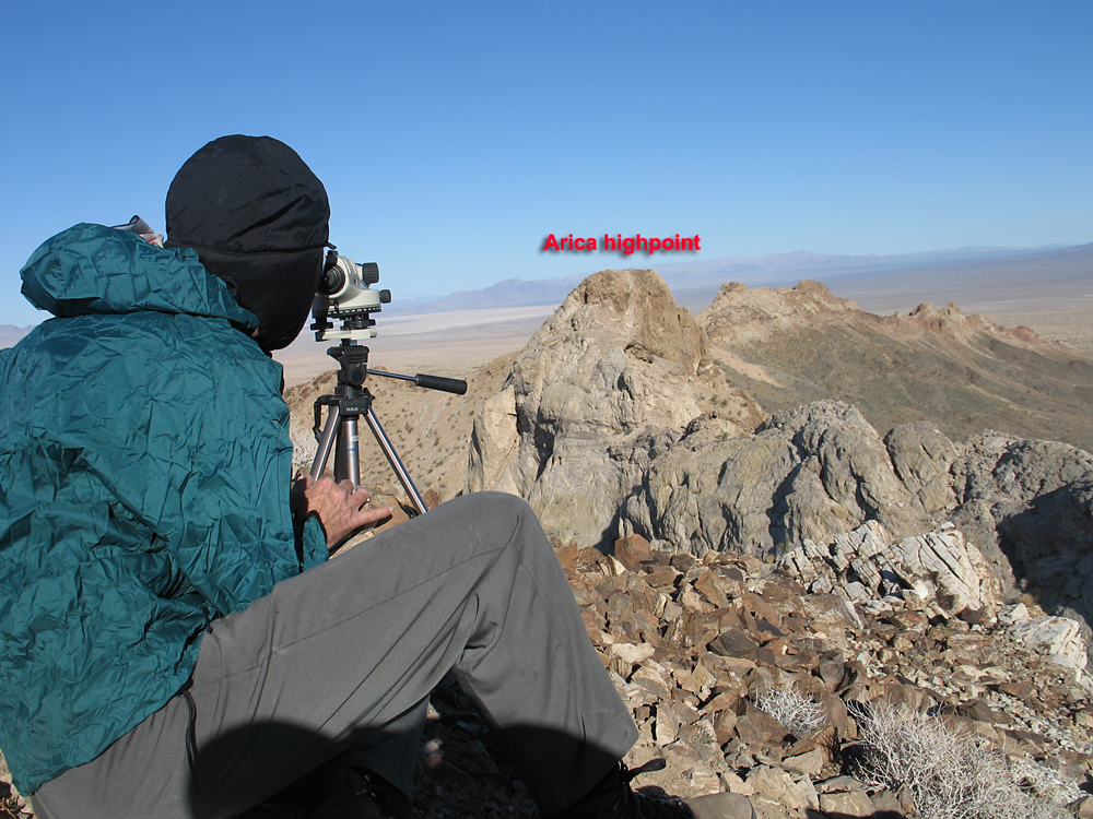
Sighting on the north summit after setting the bubble level showed it to be about 3 to 4 feet or one meter higher. In spite of strong winds that day which caused the horizontal line in the telescope to wobble, we all agreed the northern peak was higher. The south side is exposed with loose rock and we did not climb it. On a previous trip we looked at the north side and it looks difficult too. If anyone has climbed it please let me know at: richard@peakbagging.com.
Notes: The accuracy of the level is specifed as +/- 1/16 inch at 100 feet. At 1000 feet or ten times this distance the error might be +/- 5/8 inch. I plan to recheck the calibration of this unit, but it is unlikely that it is off by more than a few inches at this distance.
|
|
|
|
|
 |
|
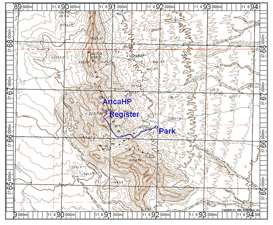
| Driving Directions: On highway 62 go about 22 miles west of Vidal Junction and turn south on Rice-Midland Road. This turn is about 24 miles east of the junction of 62 with 177. Follow the graded road south for 3.7 miles and turn right heading southwest on a fair road. Go for 1.9 miles on this to a junction by Priests Well and bear right. Continue on west and at 3.4 miles the road ends in a good camping area below the mountain. The road is washed out beyond this point and suitable only for ATV's.
Climbing Directions: The map above show the route which is about 1.2 miles one-way with a gain of about 840 feet. From the parking spot go down across the wash and follow the old road west up to a saddle. Turn north into a canyon and go up the canyon to a saddle on the ridge. From there go east on the ridge which has a faint use trail. The footing is loose and slippery. The climb up takes about 50 minutes. The map above has the UTM grid using NAD27 in zone 11. This will take you to Peak 645 meters and the register. The higher summit to the north is now in view.
|
|
|
|
|
|
|
|
|
|
|
|
|