Craggy Peak LO site, Siskiyou County, California
Located in Klamath National Forest, Elevation = 8102 ft.
|
Craggy Peak LO site, Siskiyou County, California
Located in Klamath National Forest, Elevation = 8102 ft. |
||||||
|
||||||
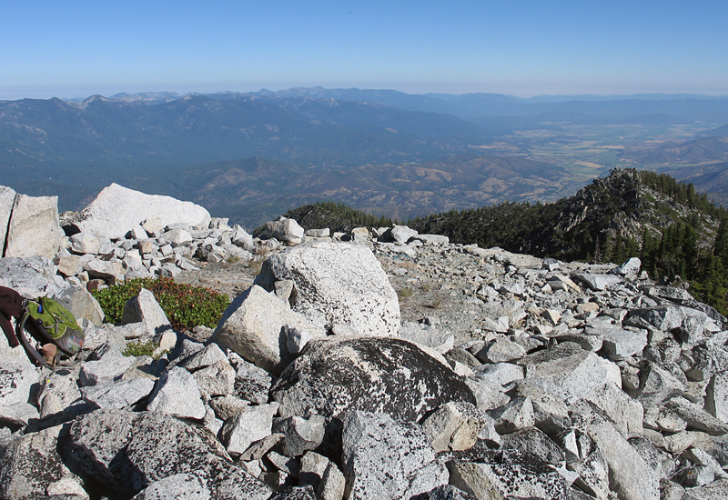
| This view looking north shows the platform where the Craggy Peak lookout cabin was. It was last used about 1922. It is not known when it was taken down. Photo taken on July 22, 2012. | ||||||
|
||||||
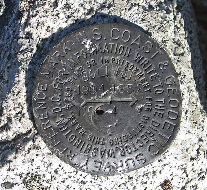
| This is reference mark #4 at Craggy Peak summit. The primary benchmark could not be found. Originally surveyed in 1904 and this disk was placed in 1952. | ||||||
|
||||||
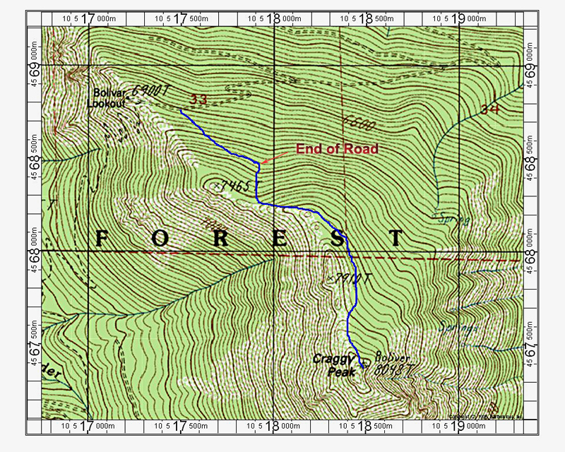
| This map shows a hiking route from the road to Bolivar Lookout to Craggy Peak. Down from the lookout walk up a steep road to its end at a graded helipad. From there go up steeply south on a logged slope to near the crest. Go east then south, staying well below the crest to avoid the rock. Pass east and below peak 7910 then head up to the slopes below the summit. The route is 1.4 miles up with about 1300 feet of gain. This map has the UTM grid using NAD27 datum, zone 10. | ||||||