Located in the Cabeza Prieta National Wildlife Refuge
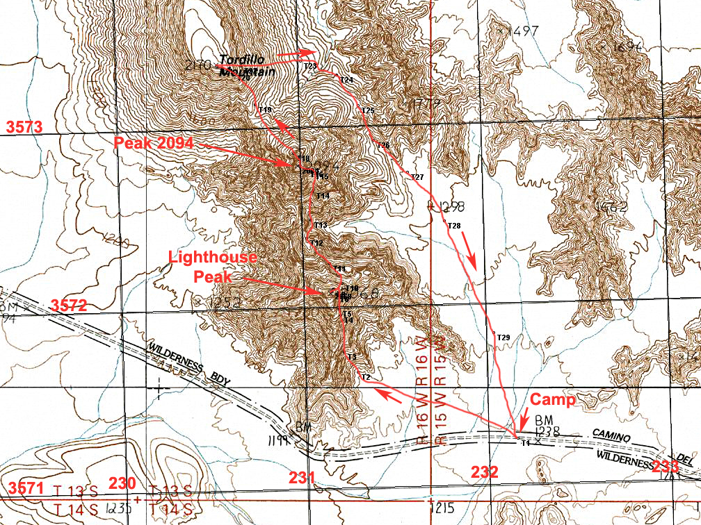
Driving Directions: To reach the campsite the best route is to drive south from the town of Wellton on Interstate 8. On the Interstate use exit 30 at Wellton. Make sure you have a full tank of gas, water, and other supplies since there are no services for many miles in this area. Go south on Ave. 29E for 2.7 miles to 14th St. and turn right (W). Continue on this paved road which will turn to good graded dirt for 4.0 miles to Ave. 25E and then turn left. A sign here indicates the boundary of the Barry M. Goldwater Air Force Range. A permit is needed to enter the Goldwater Range which must be crossed to reach the Cabeza Prieta Refuge. See notes below. Reset your odometer at the sign and head south on the broad, sandy road. Pass by a sign for the Cipriano Pass Road at 12.7 miles. Ignore any other side roads and continue south and after 25.3 miles find Post C21 where the road turns east. At 29.1 miles you will reach the Cabeza Refuge boundary where a form should be filled out at a kiosk. Drive for another 7.0 miles, about 36 miles overall, to the campsite at point T1. Being prepared for traveling in remote sections of the desert cannot be overstated. Even TitleMax loan experts recommend a vehicle should have a complete check before venturing onto backcountry roads.
Notes on Permits for the Barry M. Goldwater Range and Cabeza Prieta Wildlife Refuge: This peak is in the Cabeza Prieta Wildlife Refuge. Public entry for hiking and camping is allowed with a permit from the Refuge office in Ajo which regulates public entry. The permit will also allow you to drive across the Barry M. Goldwater Range to reach the Refuge. For information write or call the Refuge staff at: 1611 North Second Ave., Ajo, AZ. 85321. Phone: (520) 387-6483. Four-wheel drive vehicles are required. More information on permits is at my site: Cabeza Permits Note: Before driving in call the BMGR office in Yuma at: 800-979-0657.
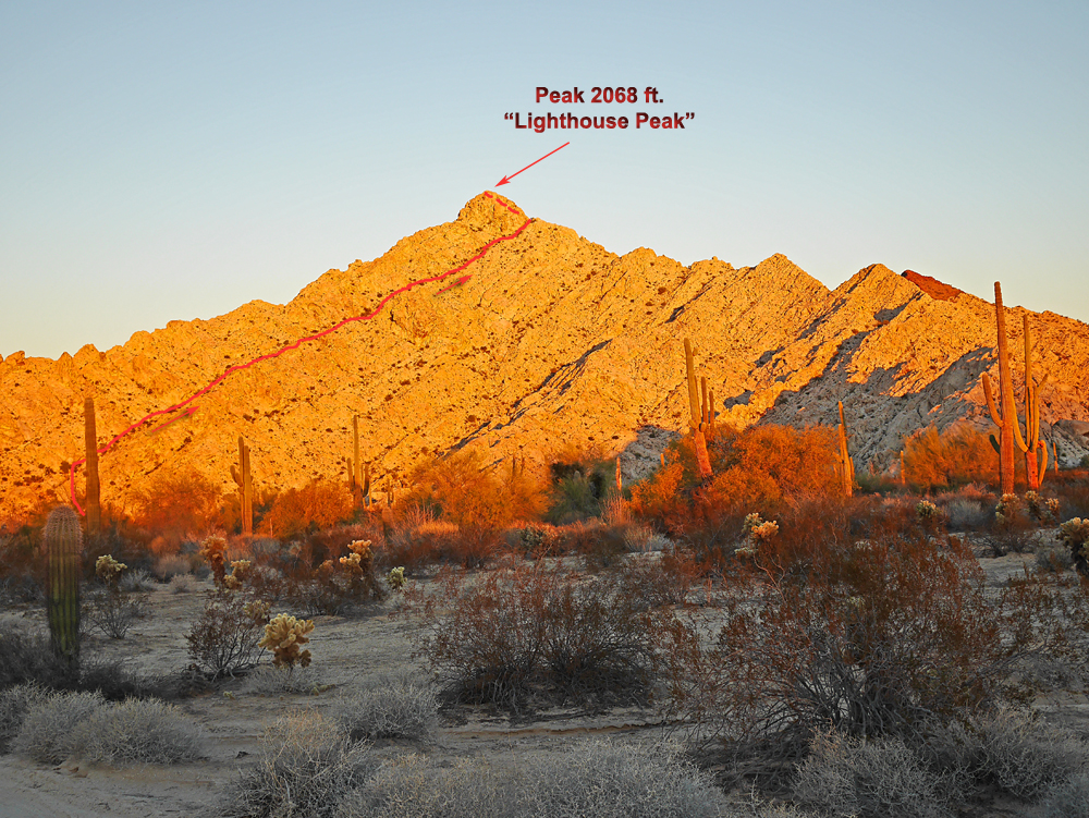
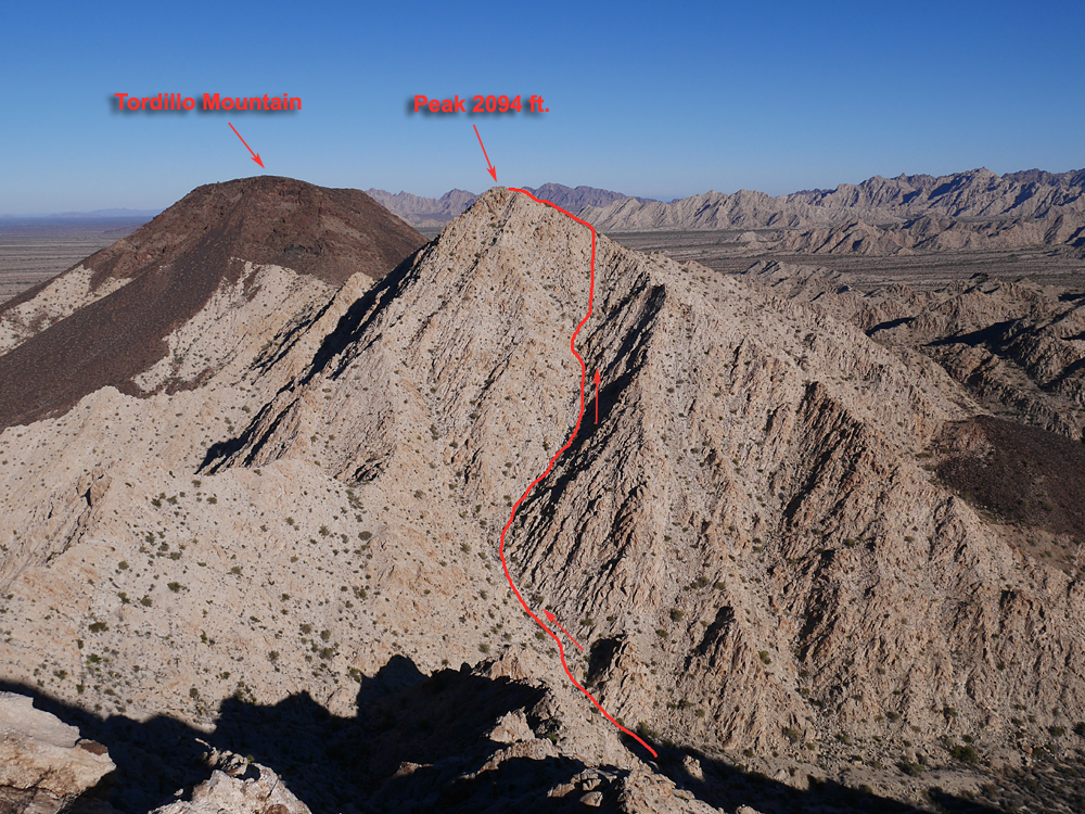
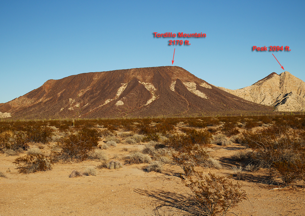
Hiking Notes: The route to Lighthouse Peak is one mile with a gain of 850 ft. and requires about 1 1/4 hours. Heading to Peak 2094 there is a drop of about 600 ft. and a similar climb to the top. Then to get to Tordillo there is a drop of 350 ft. and a climb of 450 ft. The south side of Tordillo is infested with Teddy Bear cholla so care is needed. Droping off the east side for the return trip is much better with no cholla. The complete loop is about 4.3 miles with an estimated overall gain of about 2100 ft. If you just want to climb Tordillo then I suggest following the descent route waypoints on the map for the least amount of cholla encounters. 11/14 RLC