Located in the Cabeza Prieta National Wildlife Refuge
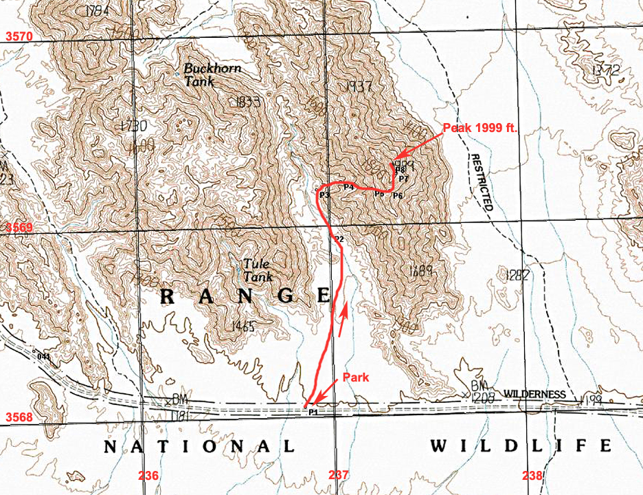
Driving Directions: To reach the starting point the best route is to drive south from the town of Wellton on Interstate 8. On the Interstate use exit 30 at Wellton. Make sure you have a full tank of gas, water, and other supplies since there are no services for many miles in this area. Go south on Ave. 29E for 2.7 miles to 14th St. and turn right (W). Continue on this paved road which will turn to good graded dirt for 4.0 miles to Ave. 25E and then turn left. A sign here indicates the boundary of the Barry M. Goldwater Air Force Range. A permit is needed to enter the Goldwater Range which must be crossed to reach the Cabeza Prieta Refuge. See notes below. Reset your odometer at the sign and head south on the broad, sandy road. Pass by a sign for the Cipriano Pass Road at 12.7 miles. Ignore any other side roads and continue south and after 25.3 miles find Post C21 where the road turns east. At 29.1 miles you will reach the Cabeza Refuge boundary where a form should be filled out at a kiosk. Drive for another 11.7 miles, about 40.8 miles overall, to the start for the climb at point P1.
Notes on Permits for the Barry M. Goldwater Range and Cabeza Prieta Wildlife Refuge: This peak is in the Cabeza Prieta Wildlife Refuge. Public entry for hiking and camping is allowed with a permit from the Refuge office in Ajo which regulates public entry. The permit will also allow you to drive across the Barry M. Goldwater Range to reach the Refuge. For information write or call the Refuge staff at: 1611 North Second Ave., Ajo, AZ. 85321. Phone: (520) 387-6483. Four-wheel drive vehicles are required. More information on permits is at my site: Cabeza Permits Note: Before driving in call the BMGR office in Yuma at: 800-979-0657.
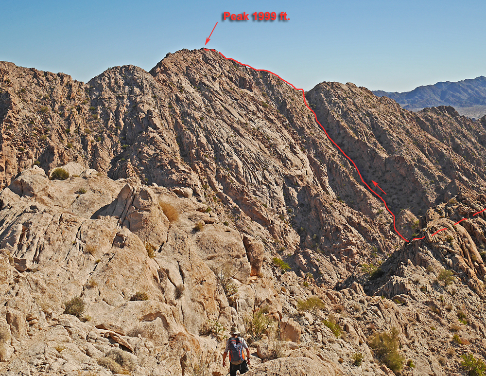
Hiking Notes: Walk north into the canyon staying to the right side. At point P3 turn right into a canyon coming down from the ridge. Go the right side in a lesser canyon which avoids a field of brown boulders in the main canyon. Climb up to the ridge line at point P6 then go left to the summit. The route is only 1.2 miles to the top with a gain of about 800 ft. 11/14 RLC